WANTED
Can you help
Woolston, Martinscroft, Paddington and Bruche have very few photos of its past. If you know of anyone who has any photos that we can borrow and scan in we would be very grateful. Could you email us on the following address info@newcuttrail.com
We would like to thank the many people who have kindly agreed to us using their amazing photos James Stubbings, Sybil Hogg, Mike Kenwright, Len England, Mary King Wallace, David Slater, Keith Bramham, Len Whittle, Linda Thompson, Marianne Pittenway, Dave Jones, Les Hogg, Donna Muncaster, David Buckles, Nick McCarthy, Dave Slater, Jim Hunter and Jann Gregson
*******************************************************
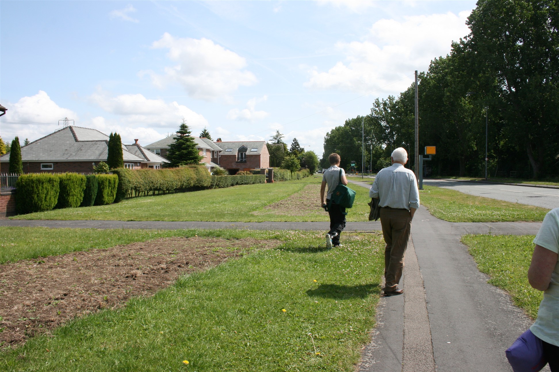
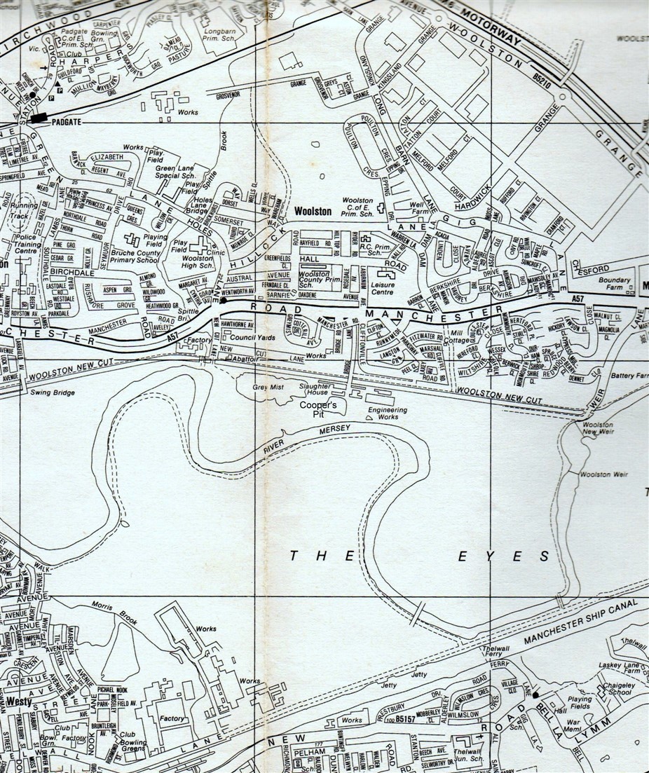
On Sunday, 4 October 2015 the New Cut Heritage group organized a historical walk around Woolston starting at The Dog and Partridge pointing out items of interest along the way.
This is a brief introduction with a guided walk to follow
People lived in our area during the Bronze Age 2000BC.
We know the Anglo-Saxons arrived here around 700 AD. The word ‘Ees’, as in Woolston Eyes, is Saxon for land near a looping watercourse.
The name Woolston first appears in 1180 in a charter and derives from the Old English of ‘Wulfes’, or ‘Wulfsiges’ (a personal name) and also ‘tun’.
The Woolston family lived in Woolston Hall from the 13th to 15th centuries until it was passed to the Hawarden family by marriage.
In 1367 there were reports of fishermen brought before the courts for obstructing the flow of the river with fish weirs; and that so many salmon were caught that all the countryside and markets for twenty miles around were supplied.
A later account says that the Mersey had sturgeons, mullet, seals and eels, lobsters, shrimps, prawns and ‘the best and largest cockles in all England.
In 1749 a 19 and 23 pound salmon were recorded as being caught in May on the Mersey in the Woolston and Thelwall area.
The Mersey has always had a problem with flooding, during the winter months the Mersey used to flood but it is believed that sheep were grazed on the fertile fields in the summer months.
[nggallery id=”8″]
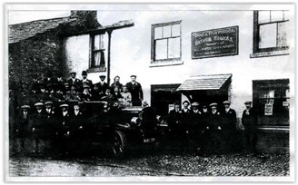
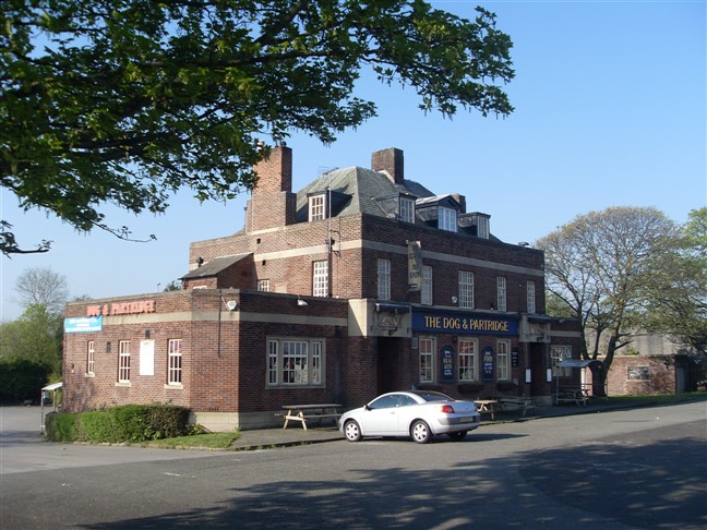
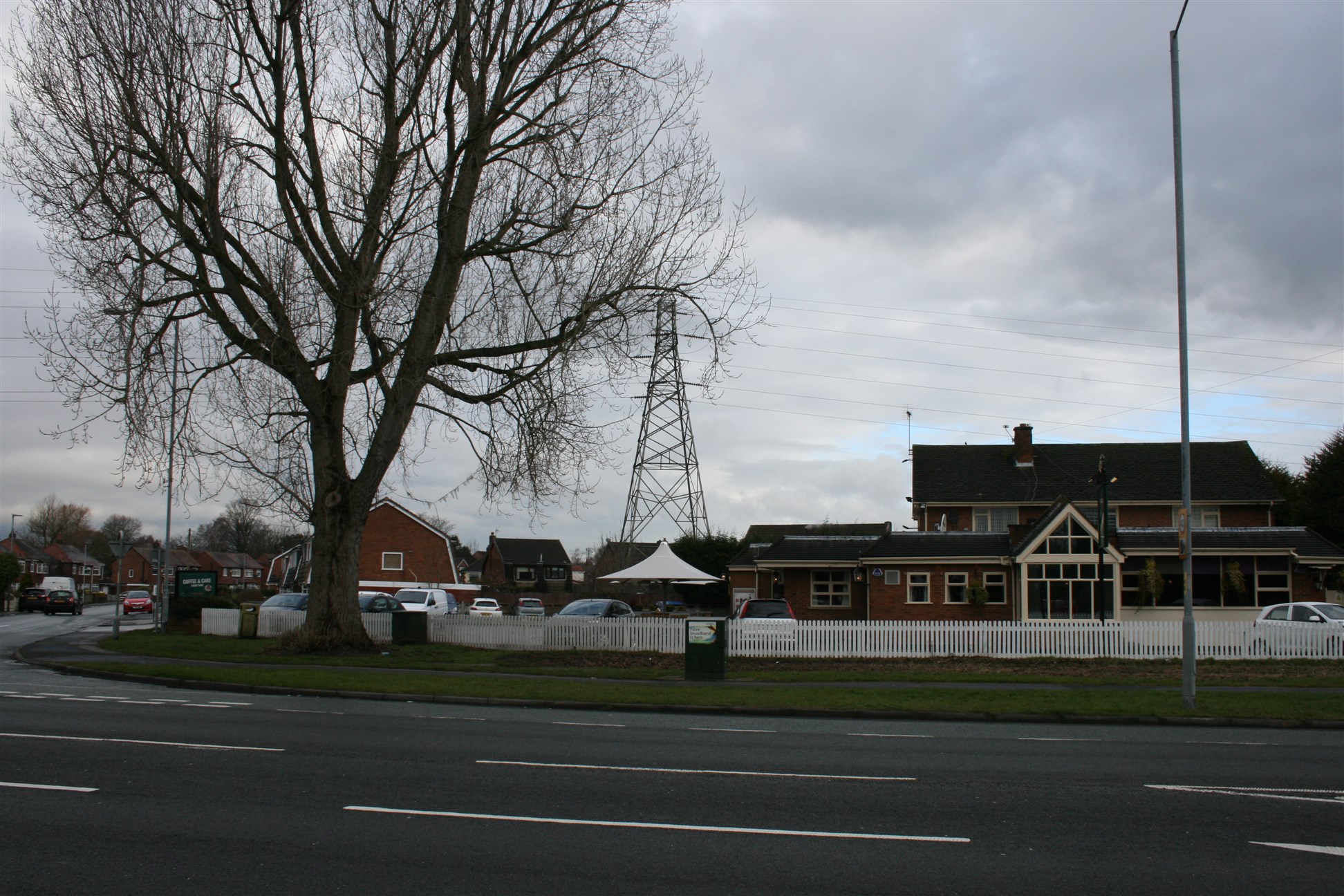
The old Dog and Partridge was open before 1826 and was attached to the black cottages which were all owned by the brewery. This was pulled down when the new Dog and Partridge was built in the 1930’s behind the existing Dog and Partridge.
1901 census licensed victualler Walter Kerfoot age 38, Elizabeth Kerfoot age 36, children Mary age 8, Frank age 6 and Ethel age 4.
1911 census Inn keeper Arthur Hughes (see photo) age 41, Harriet Hughes wife age 42,
children Ethel age 12 and Stanley age 8.
William and Ethel Monks were known to have lived there from 1939 -1952.
Walk along the old A57 approx 209 metres / 0.13 miles until you get to Soapery Row on the left.
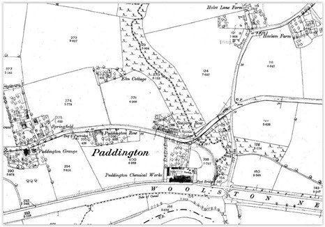
2 Soapery Row
If you look at the picture in the distance on the right hand side you will see Soapery Row which was a group of terrace houses. Paddington Chemical works built these for their workers to live in. These cottages were on the old Manchester Road, they were knocked down and replaced with semi detached houses circa 1978.
In 1820 a soap works was owned by Jonathan Jackson, he lived at Bruche Hall which became a convent. The soap works became the bone works.
In 1851 The Chester Chronicle announced the Paddington Bone Works were selling boiled bones.
In 1868 The Chemical Manufactories listed Christopher Royston at Paddington Works.
The Post Office Directory of 1876 listed W & C Royston as Soap & Chemical Manufacturers.
Slaters Directory of Cheshire of 1895 listed William Royston & Co, Paddington Works, as soap, glue, size & bone manure manufacturers.
1901 census
Labourer, Edward Schottage age 38, Mary Schottage age 39, Edward Schottage age 14, Alfred Schottage age 6, Alexander Schottage age 1.
Labourer, Thomas Morris age 44, Catherine Morris age 38, Mary, Morris age 10, Joseph Morris age 7, Charles Morris age 2.
Glass blower, George Jackson age 45, Margaret Jackson age 44, Edith Jackson age 14, Benjamin Jackson age 10, Josie Jackson age 8, Sarah Jackson age 5, Maggie Jackson age 5.
Signal, James Potter age 40, Ellen Potter age 38, Sarah Potter age 16, John Potter age 14.
David Clarke 76, John Clarke son age 35 labourer, Elizabeth Marsden daughter age 35, William Marsden 32 son-in-law,
Mary Clarke g/d age 22, Alice Marsden g/d age 6, Ellen Marsden g/d age 5 Lawrence Marsden g/s age 3, Florence Marsden g/d age 1.
Carry on walking for approx 128 metres / 0.08 miles and look at the map to see where the toll bar was.
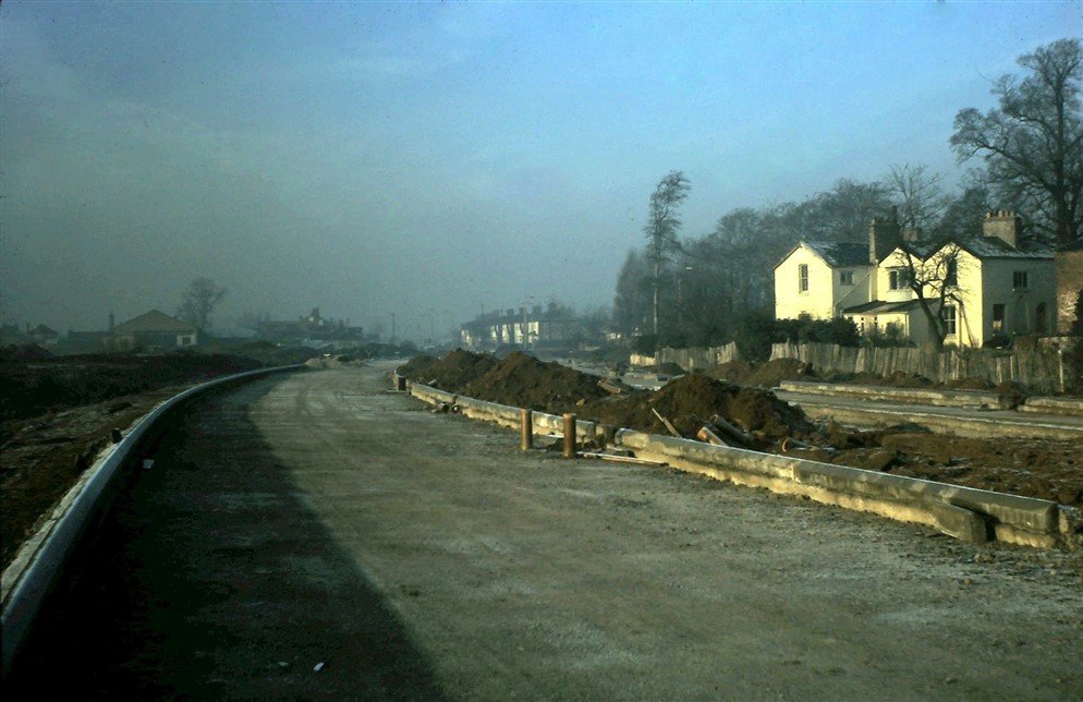
The picture shows the new A57 being constructed in 1970 behind the Dog and Partridge.
The old A57 ran in-front of the Dog and Partridge but due to increase in traffic it was decided to build a dual carriageway behind it.
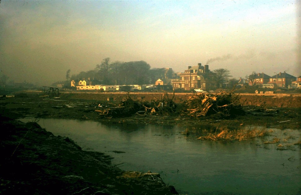
The picture shows the New Cut Canal in the foreground.
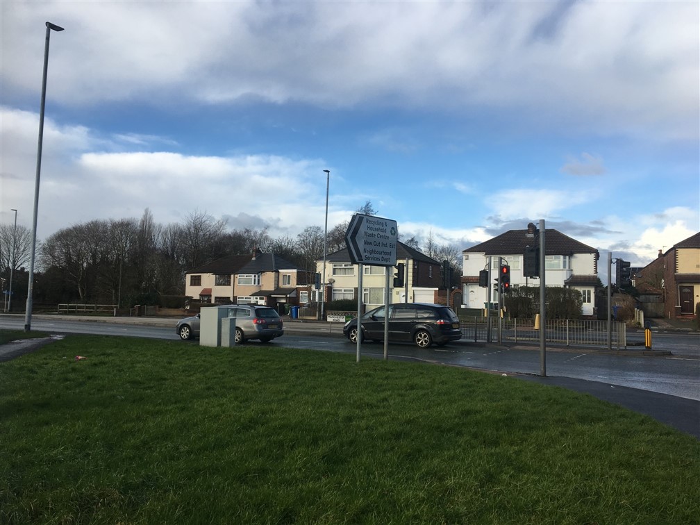
The map shows the toll bar near Spittle Brook somewhere near where the traffic lights are now.
This was a bar or a gate, stopping travel at a point where tolls were taken.
There was a lot of trouble over toll bars and the one at Glazebrook was pulled down by local people.
Carry on for 64 metres / 0.04 miles until you get to the traffic lights and cross the road.
There was a finger post situated where the traffic lights are now until the 1960’s. This was usually a black and white post with one or more arms, known as fingers. The fingers pointed in the direction of travel, the place names were on the fingers.
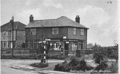
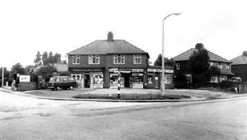
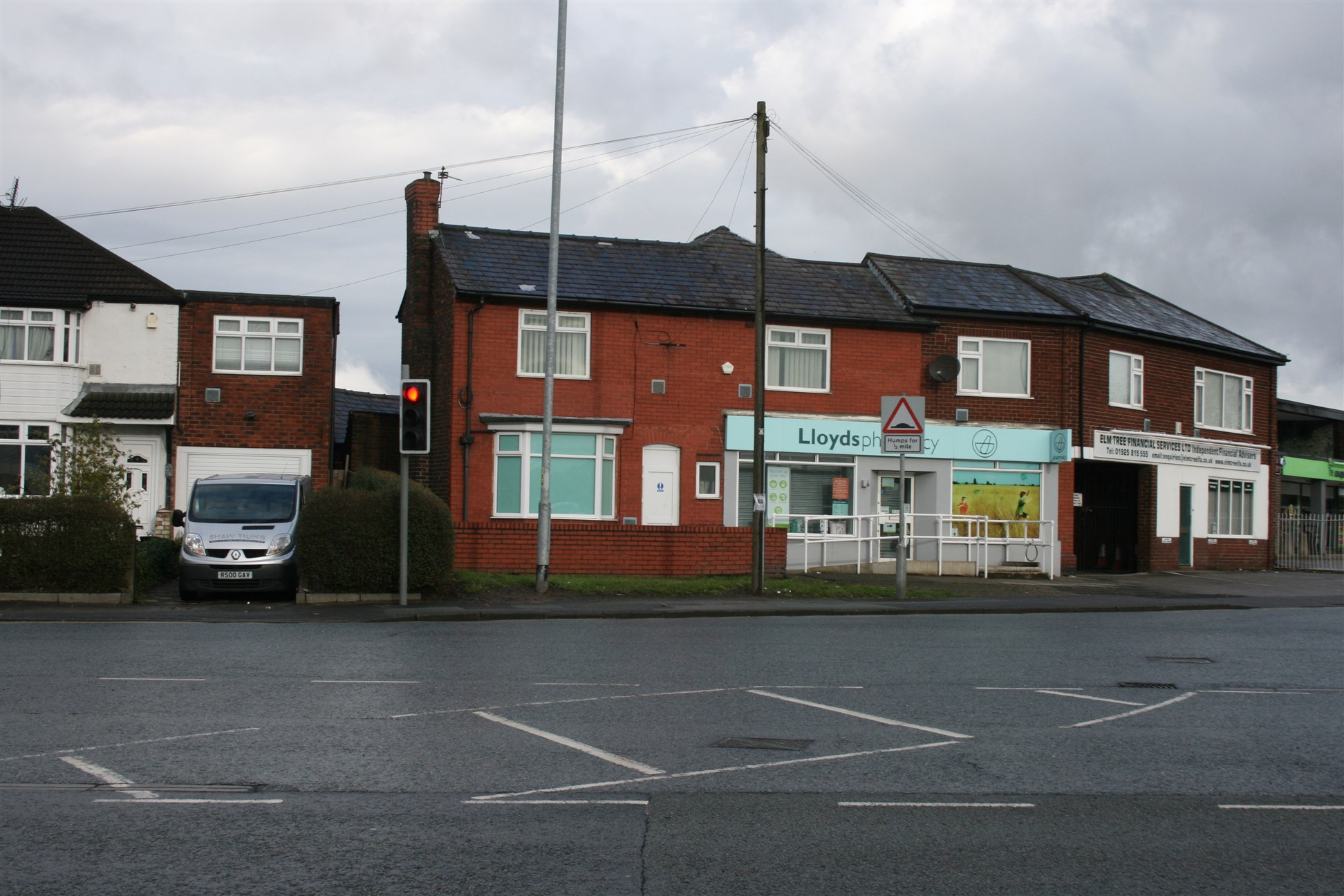
The Paddington Post Office was originally where Lloyds Chemist is now.
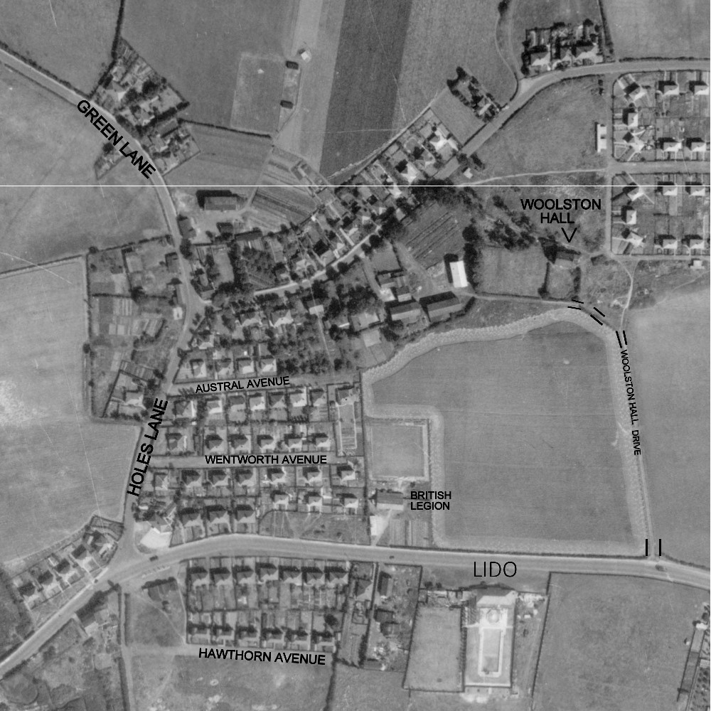
Optional walk approx 611 metres / 0.38 miles up Holes Lane until you get to Padgate Cottage Homes on your right, passing where Holes Lane farm was on the corner of Holes Lane and Hillock Lane.
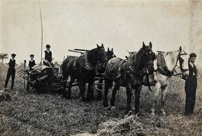
On the way to Padgate homes you pass where Holes Lane Farm was on the corner of Holes Lane and Hillock Lane. The picture shows Holes Lane Farm and horses pulling a binding and reaping machine.
Warrington Union opened what was known as the Padgate Industrial Schools in 1881.
The initial site was based on a quadrangle with, at each corner a home for 50 children – the two on the west for boys and the two on the east for girls.
On the south side was the school and classrooms and on the northside was the surgery, stores, offices laundry, piggeries, stable and outbuildings.
Each of the four two-storey homes has, on the ground floor a kitchen, dining room, workroom, pantries, bathroom and toilet and two sitting rooms for the officers. Upstairs were three dormitories for the children, and bedrooms for the officers.
The school later became known as Padgate Cottage Homes. In 1911, 200 children were living there.
In 1950, the cottage homes had another name change and became known as Padgate Hall but in 1953, the homes closed.
A child remembered how he first went to live there in 1948 as a 6 year old and finally left in 1953 as a 12 year old. Although life in there was quite tough, you have to remember that it was tough for most folk at that time. The good memories vastly outweigh the bad memories. Good memories, including the annual 4 week camp at Knott-End-on-Sea, trips out to places like the Lakes and even as far as London to the Festival of Britain. But Christmas times were fantastic, apart from the in-house celebrations, we were invited to parties given by the RAF and also the Americans at Burtonwood. The thing is, when you live in a home with upwards of 130 children there is always someone to play with. The house straight across from the gates was my first call on bob-a-job day, they were great people who always found us some little job or other, whether it be a bit of weeding or polishing the silver, anything just so we could earn our shilling. The view up the lane reminds me of walking excitedly up to the bus stop at Paddington post office to meet visiting relatives, though that was a pretty rare thing.
Turn around and walk back to the Post Office. Then walk approx 225 metres /0.14 miles up Manchester Road towards the M6 until you are opposite the Petrol Station.
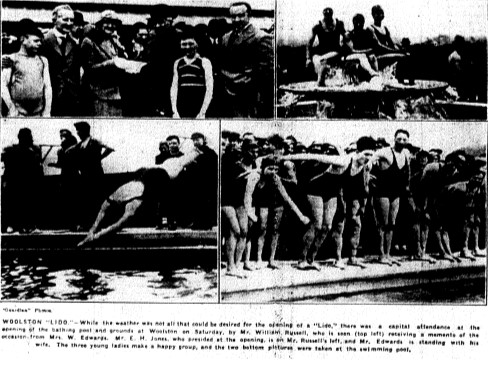
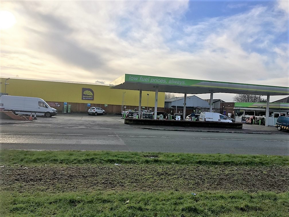
This was in Woolston on the A57 where the yellow storage depot and garage are now, however wet summers put people off and the pool fell into disuse.
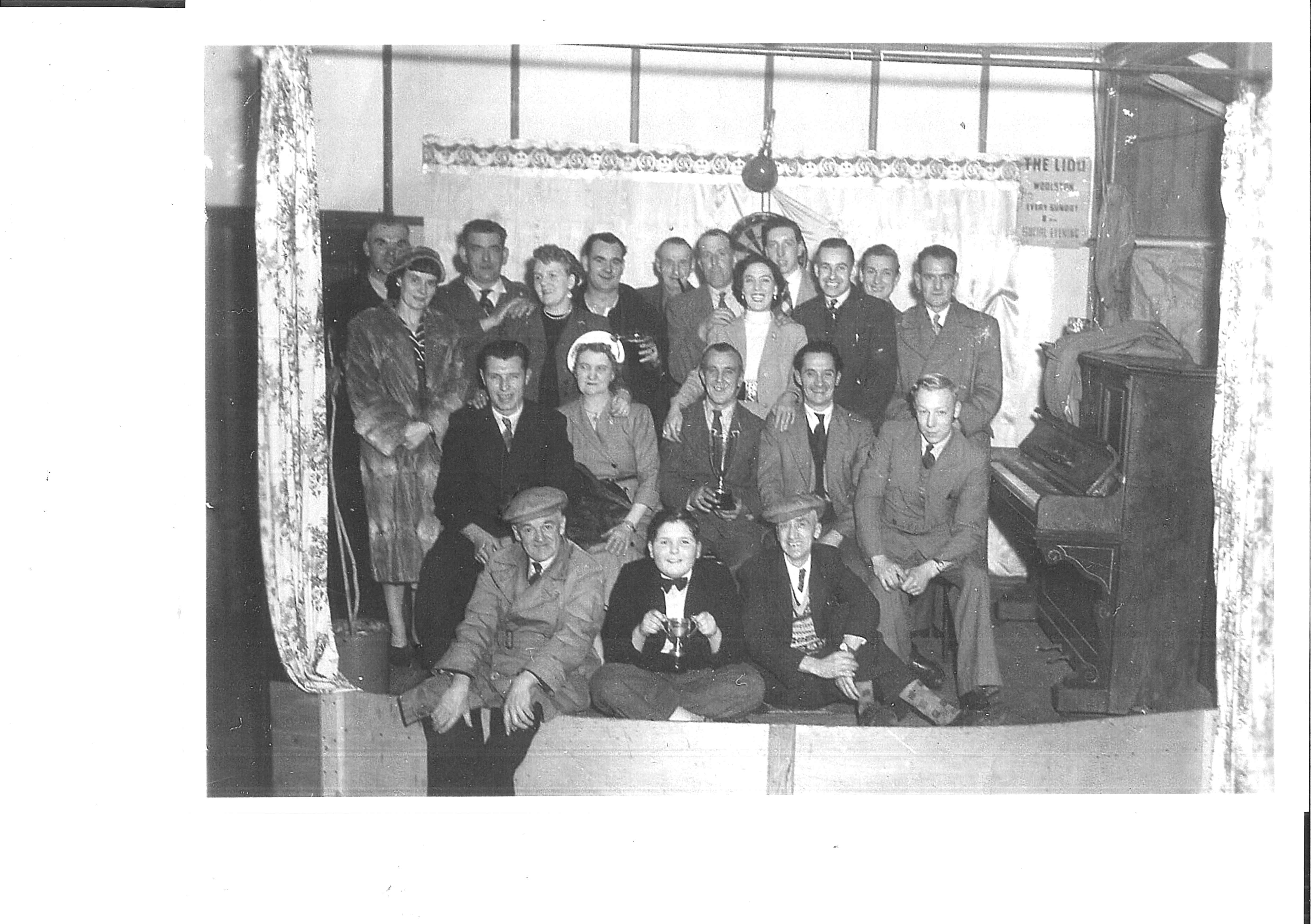
The Lido was opened on Whit Saturday, 19 May 1934. We believe it was the first open air swimming pool which could be heated artificially. The pool was floodlite from underneath and was 100ft x 42ft.
Towards the end of it’s life there were caravans to the side of it and carp were in the pool. In the winter one gentleman remembered having to break the ice so the carp could breath. There was also a transport café and a pharmacy. The area was called the Black Cat.
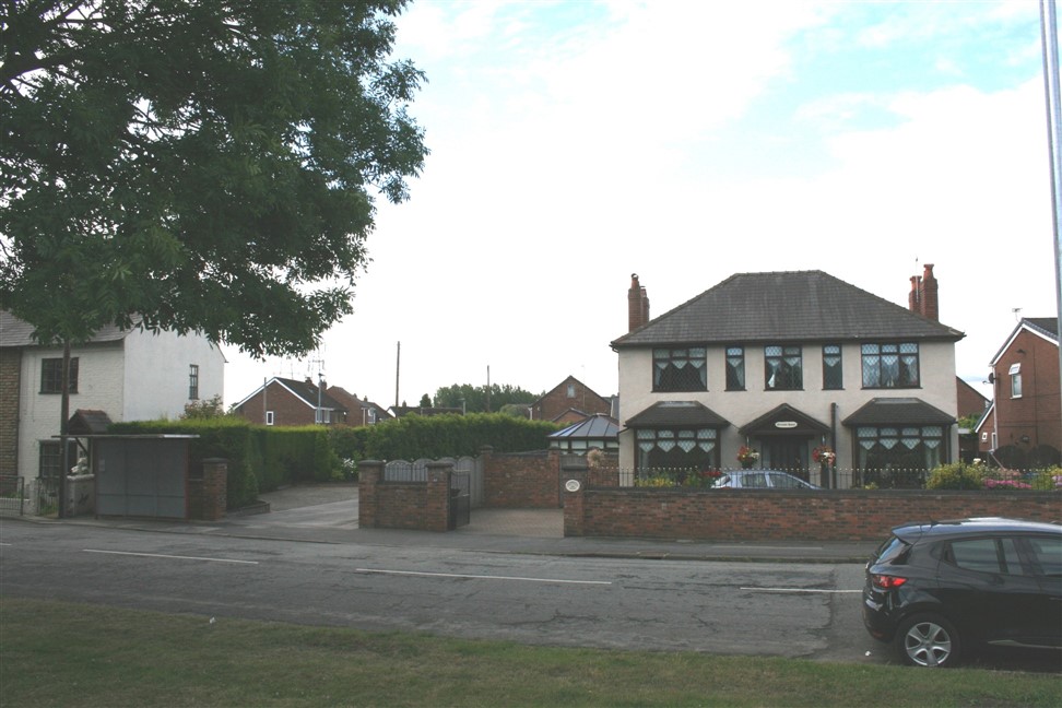
Carry on walking approx 225 metres /0.14 miles until you see a large double fronted detached house on the right.
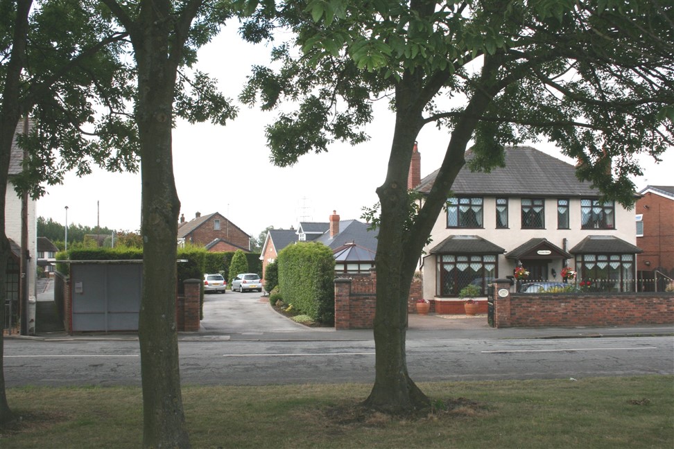
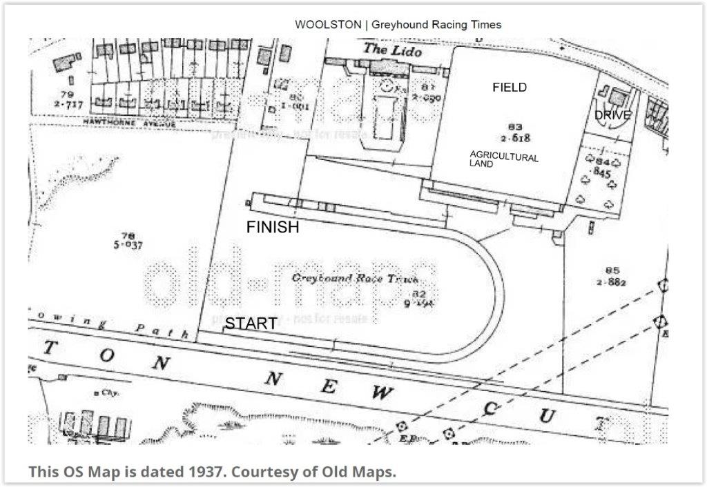
The entrance to the greyhound track was the alley way behind the bus stop, at one time it was a road, wide enough to drive down. It was owned by Mr Jones the Chemist/herbalist who’s detached house still stands beside the bus stop, his daughter was called Sheila.
The track opened on 12th September 1934, the track described as being horseshoe shaped closed in 1937. It was a U shape with a start, bend then a finish.
The greyhound track was for greyhounds starting out and practicing before they went to a proper track where they got their number and were weighed.
It was a flapping track, this is where you could race your dog in a 6 dog race without having to produce a race book, you could name your dog whatever you wanted, not a racing name, the dog didn’t have to be weighed in. It was good for pups to learn what was expected of them at the track.
They were not answerable to any governing body.
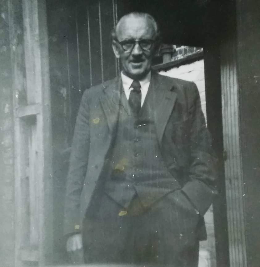
This is a picture of Mr Jones, taken in October 1954, just before he retired from being a herbalist on Mersey Street. He rented his herbalist shop from Jane Higgins of Bewsey Street. We believe he also worked at Paddington Chemical Works.
Mr Jones lived on Manchester Road in Greymist House near the Lido and Grey hound track, he was proprietor of both. He was a quack doctor and general entrepreneur. Mr Jones had a surgery at the bottom end of his garden. The entrance was from the top of Greymist Avenue.
The photo was taken by Edna Garner. His daughters were called Elise Jones and Sheila Jones.
Turn around and walk back the way you have come approx 80 metres / 0.05 miles.
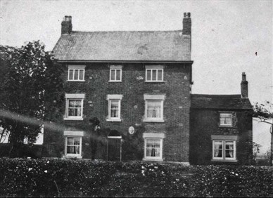
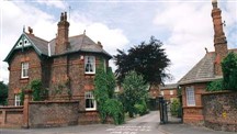
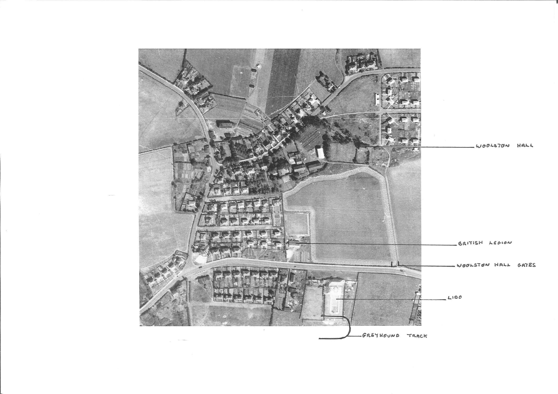
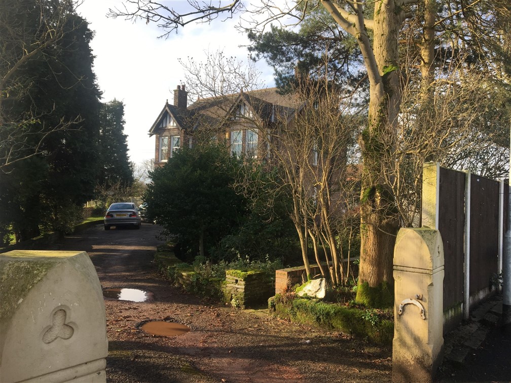
The first picture shows where the entrance to Woolston Hall was off Manchester Road, to the right of the present Barnfield Road. At the entrance to the drive were a pair of gateposts, the driveway itself consisted of granite setts and on either side there were fields which during the 1950s were farmed by James Abbey of Hillock Lane. There was another entrance to the Hall from Hillock Lane.
Turn right into Barnfield Avenue and walk approx 240 metres / 0.15 miles to Greenfields Close on your left.
The other photos show Woolston Hall and where it used to be at the bottom of Greenfields Close.
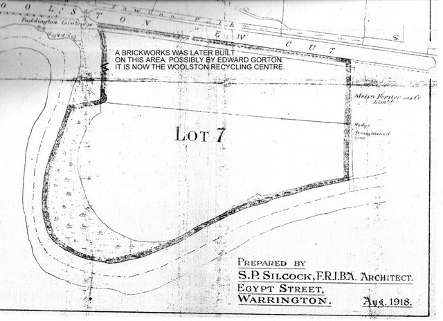
1869 (Woolston Hall Estate)
Containing Upwards of 1,070 Acres of Rich Arable, Pasture and Wood Lands, with Several Farm Houses and Suitable Farm Buildings and Cottages, with the “Rope and Anchor” Inn in the Village of Woolston.
From 1677 to 1831 a Catholic priest resided at Woolston Hall, they were all English Benedictines.
The Registers of Estates of Lancashire Papists 1717-1788:
The Woolston family lived in Woolston Hall from the 13th to 15th centuries until it was passed to the Hawarden family from Flintshire in the fifteenth century, and then by marriage in 1575 to the Standish family. The manor was now called Woolston Hall and stood at the top end of Greenfield Close.
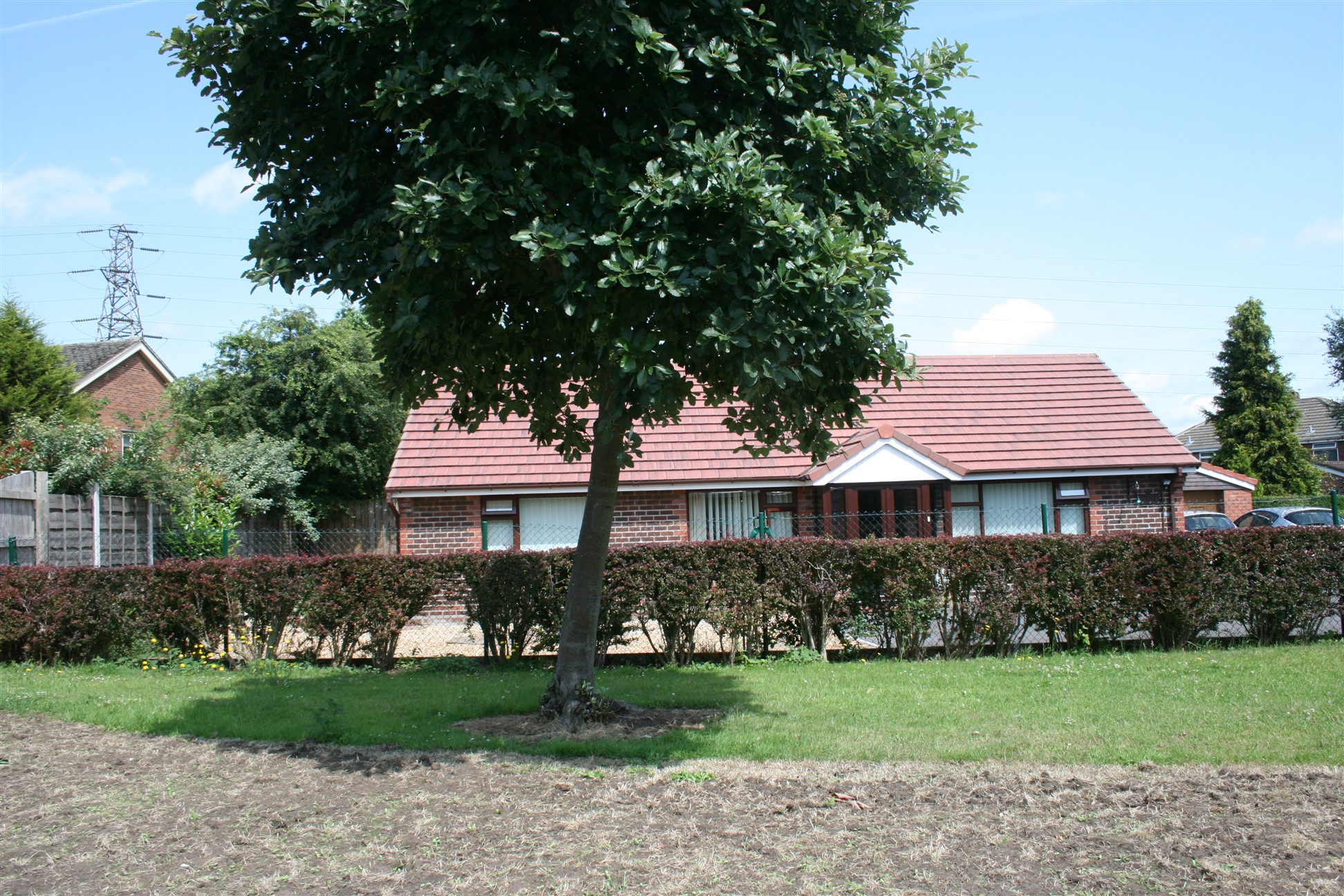
Woolston Hall was demolished in 1947 to make room for Woolston County Primary School and neighbouring housing developments. The school was opened in January 1952.
From 1841 – 1911 the Hatton’s Houghton’s, Fowler’s and Platt’s occupied the Hall as farmers.
Carry on walking approx 177 metres / 0.11 miles until you reach Hillock Lane and turn right.
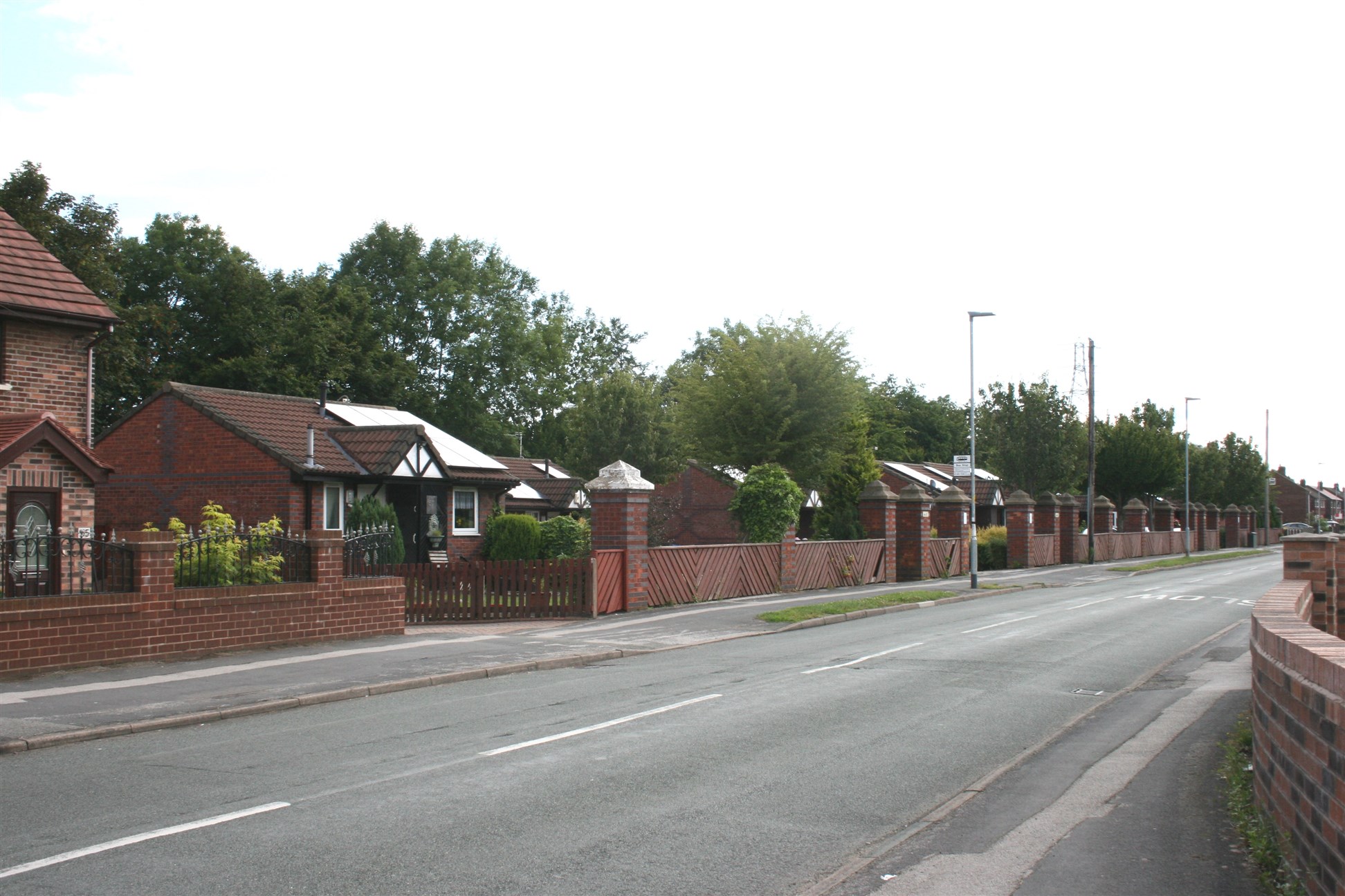
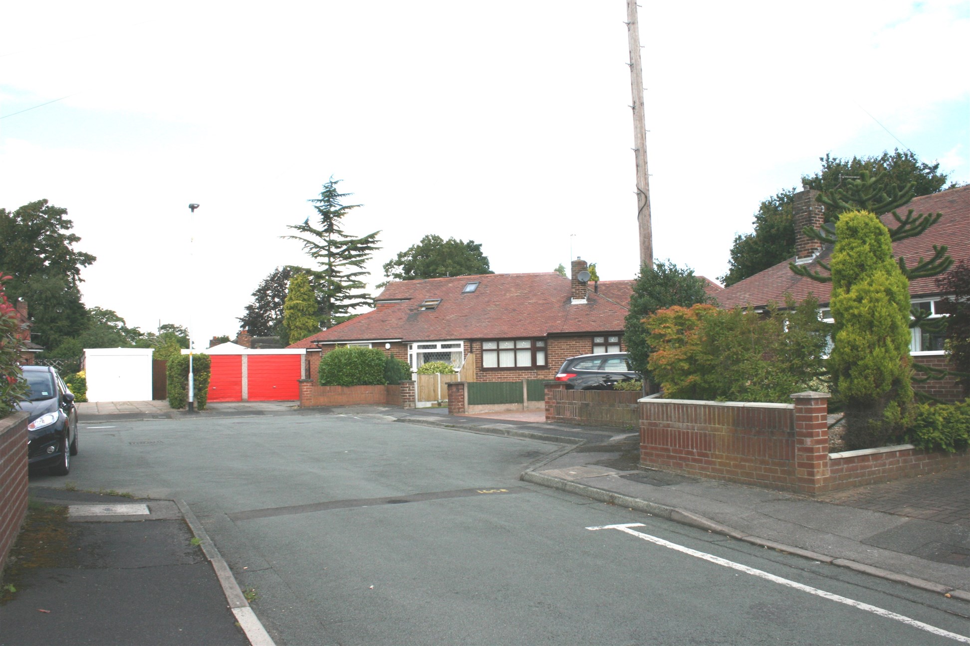
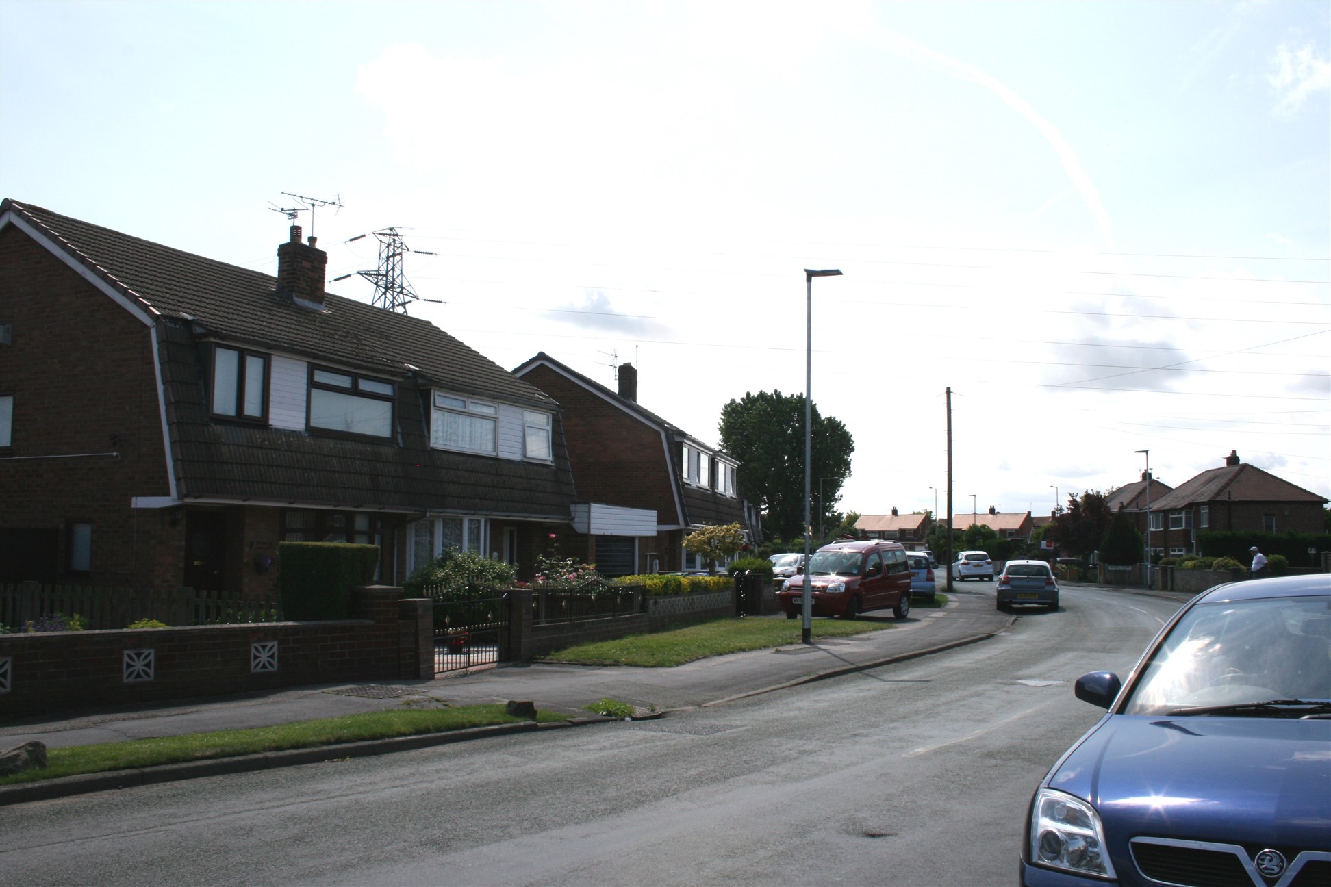
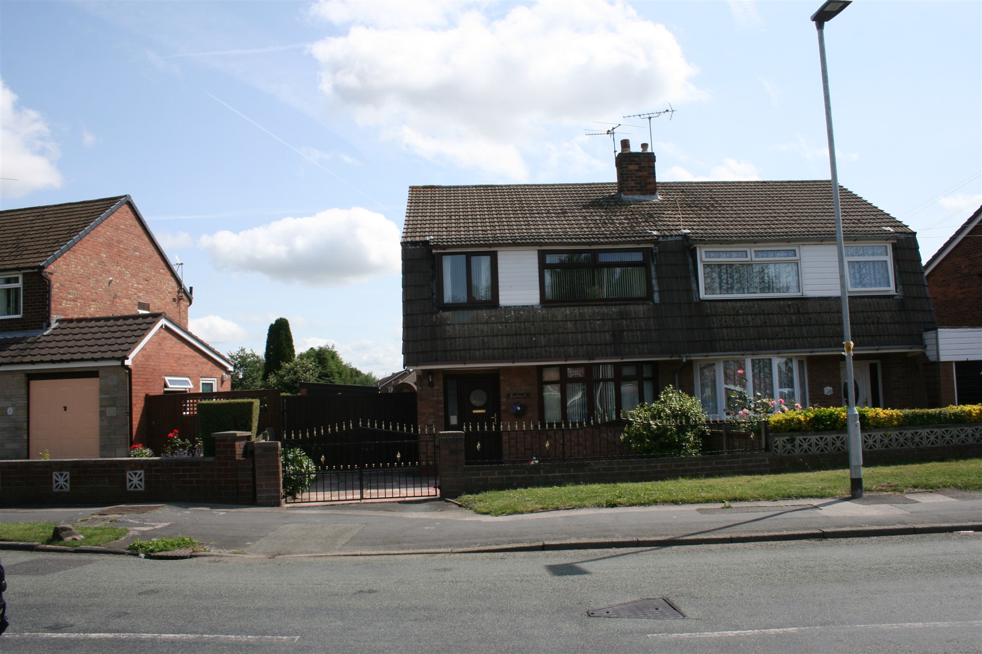
There was a group of Airey houses on Hillock Lane on the left hand side where the current set of walled bungalows are currently located.
An Airey house was a type of prefabricated house built in Great Britain following World War II. These were designed by Sir Edwin Airey to the Ministry of Works Emergency Factory Made housing programme, it features a frame of prefabricated concrete columns reinforced with tubing recycled from the frames of military vehicles.
To the left of the site of where the Airey houses were built, there is an electricity sub-station set back behind the houses, backing on the playing fields and in between are two houses which were built by the Warrington Corporation Waterworks department to house some of their employees. Quite why these houses were located there, not close to any water installation, is unknown.
The markings on the road is where a new sewerage system was put in. This had unhappy consequences for one Woolston family.
Walk approx 225 metres / 0.14 miles until you reach Ryder Road on your right.
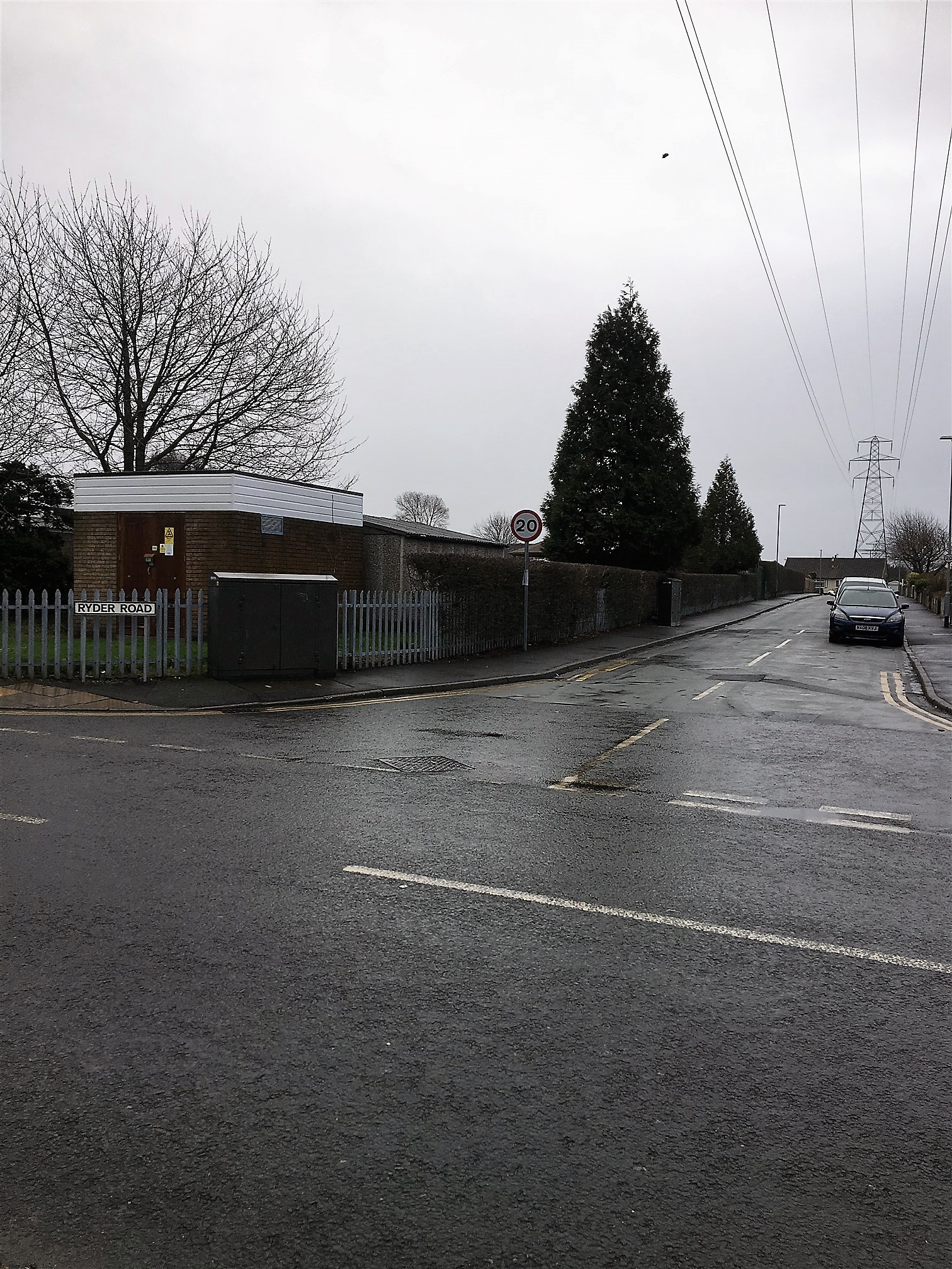
Ryder Road was named after Mr Ryder, who was a Headmaster at the Mission Church of England School on Warren Lane.
Carry on on for approx 160 metres / 0.10 along Hillock Lane then right into Warren Lane.
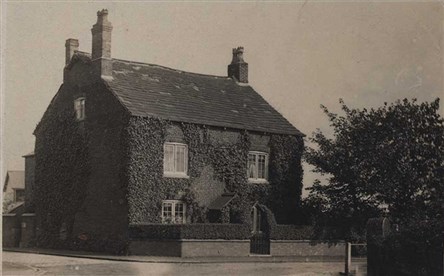
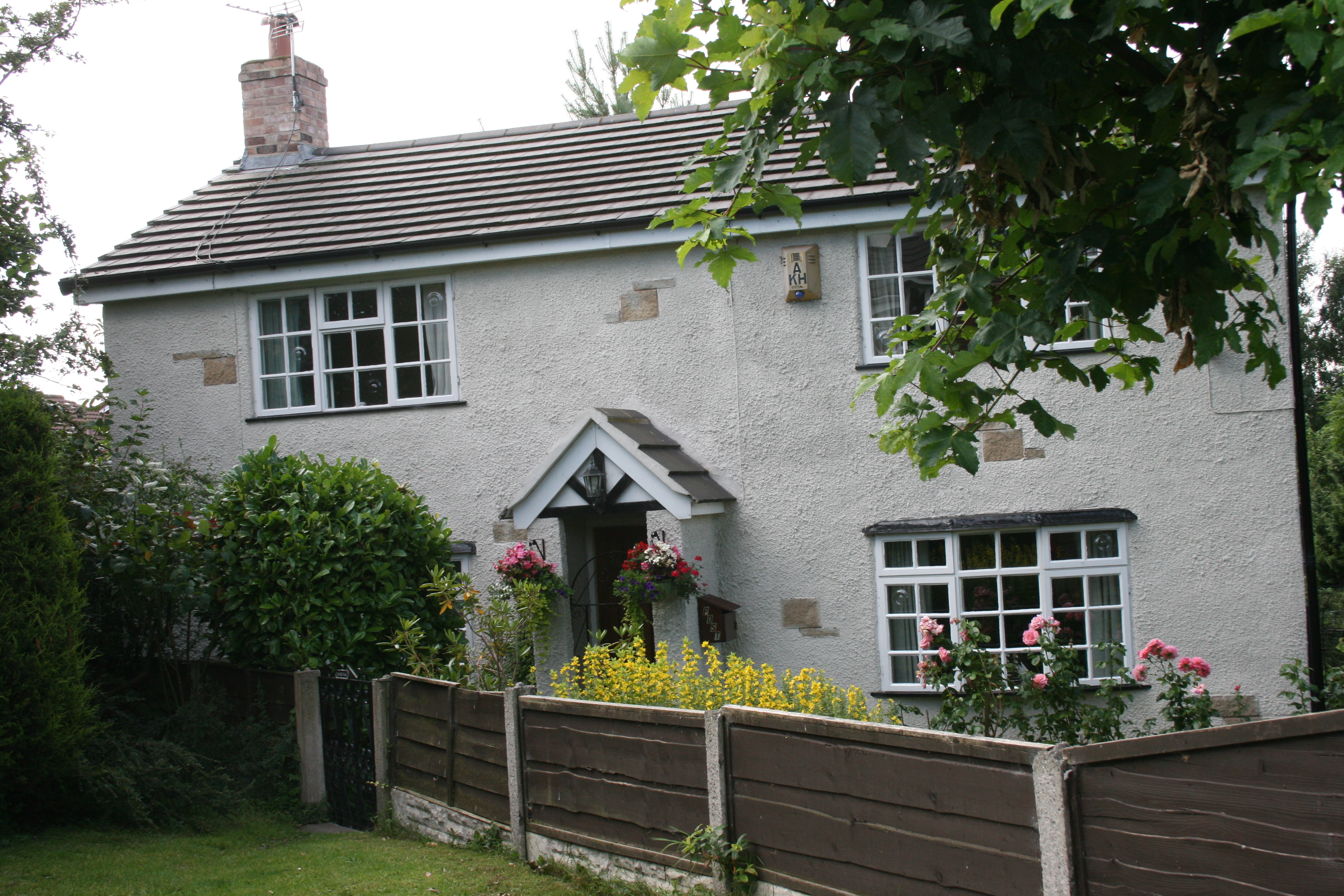
The property was owned by Edward Gorton a glue manufacturer.
In the 1940’s – 1950’s the property became a maternity nursing home. At one time it was run by Alex Clarke’s wife and her sisters. Eventually the Clarke family moved in and David their son still lives in the house.
The area was called Warren as there had been a rabbit warren there. A rabbit keeper was employed to look after them and supply meat to Woolston Hall.
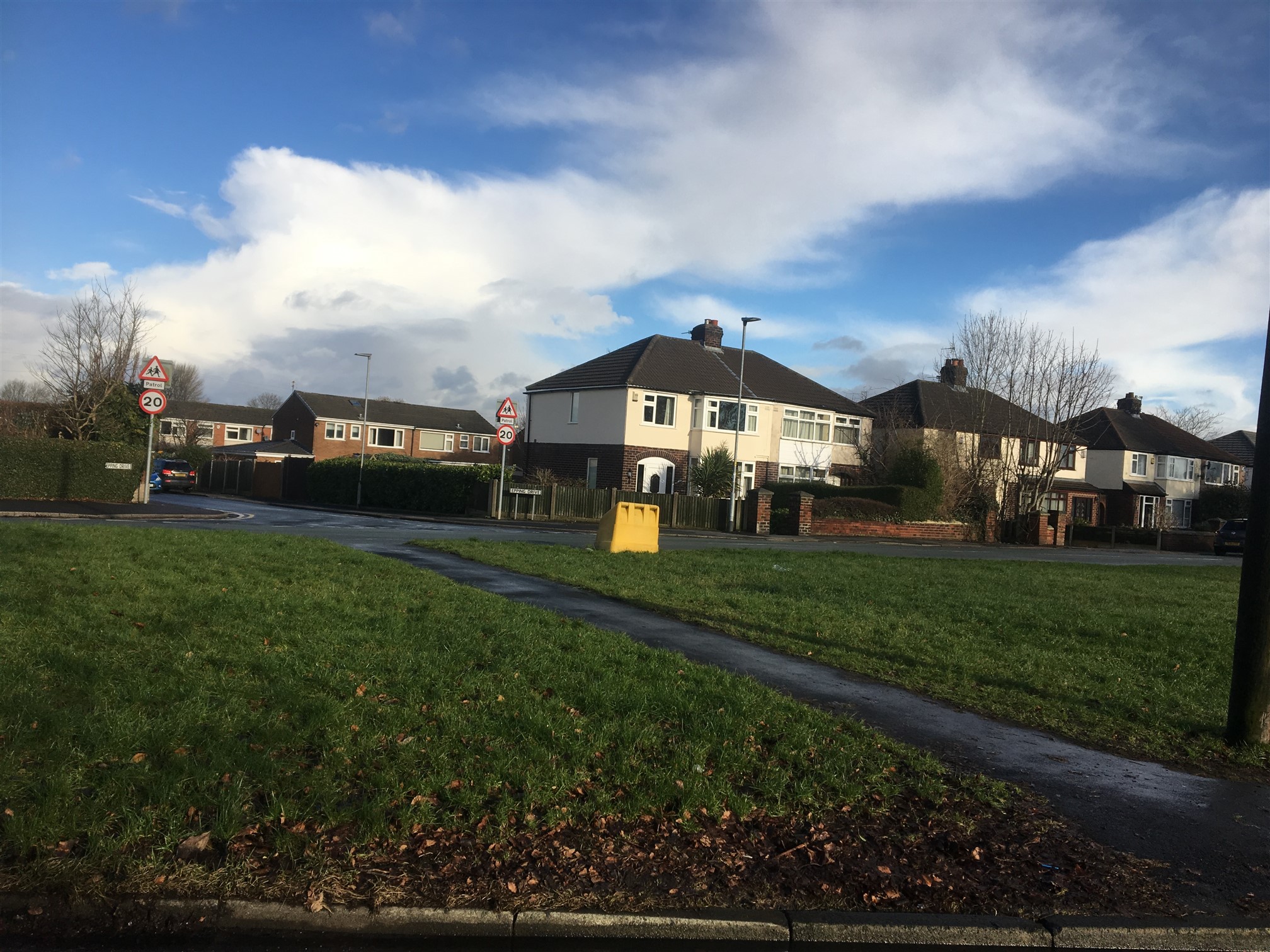
Where Epping Drive is now it was originally called Hollywood Estates.
At sometime in the past a farm was opposite Warren Hill. We can’t find any record of a name for it other than Rough Intake. This might well have been the name for it. Intake was a word that was used to describe land that had been taken into cultivation and there is at least one farm in Yorkshire known as Intake Farm.
In Glazebrook on the land that was farmed by Ruth’s Kenwright’s Great granddad some of the fields had the word intake in their name, such as “New Intake” for instance.
In the 1940s the only thing left of the farm on Hillock Lane was a barn on a small plot of land. It was owned by a John Jackson who lived on Manchester Road, from what we understand he was a fan of Hollywood in the USA and he got someone to paint Hollywood Estates on the double doors at the front of the barn.
Carry on along Warren Lane for approx 112 metres / 0.07 miles.
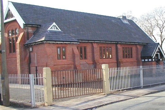
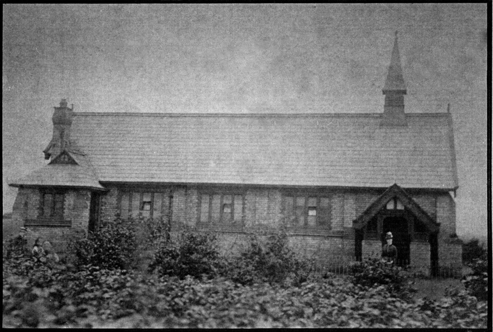
The Church of England school – the Mission – was opened in 1885. Mr William Beamont built the school for £1100.00 for local people.
When Mike Kenwright was growing up the mission was his day school, Sunday school/church and village hall all rolled into one.
The Mission was built as a ‘mission’ or offshoot of Padgate Church and dates back to 1884. It operated as a day school with the main hall being used as two classrooms separated by a black curtain, with unruly pupils poking small holes with the old “dippingpens” in the curtain so that they could see what was happening in the adjoining class! The door opposite the entrance was the headmaster’s room and was at the back of the building. This was the top classroom for the 9-10 year old pupils, his desk was on an angle to the left of the door.
There were just three classes each one with two age groups in them. Unlike modern schools the mission didn’t have an office or a secretary. The headmaster often dealt with visitors in the classroom as he was teaching. At the other end of the building, the doors either side of the chancel lead into what were both used as cloakrooms and had washbasins in them.
On the top of the building there used to be a spire on the right with a bell inside.
The vicarage was located to the right of the Mission and was once the home of Mr Entwistle, the Headmaster at the Mission at that time.
In 1906 Edward Dennett, offered a site on Manchester Road near Martinscroft but nothing came of this.
In 1917 Edward Gorton donated the plot of land bounded by Hillock, Warren and Dam Lane as a site for the church. He was a Glue Manufacturer and he lived at Warren Hill,
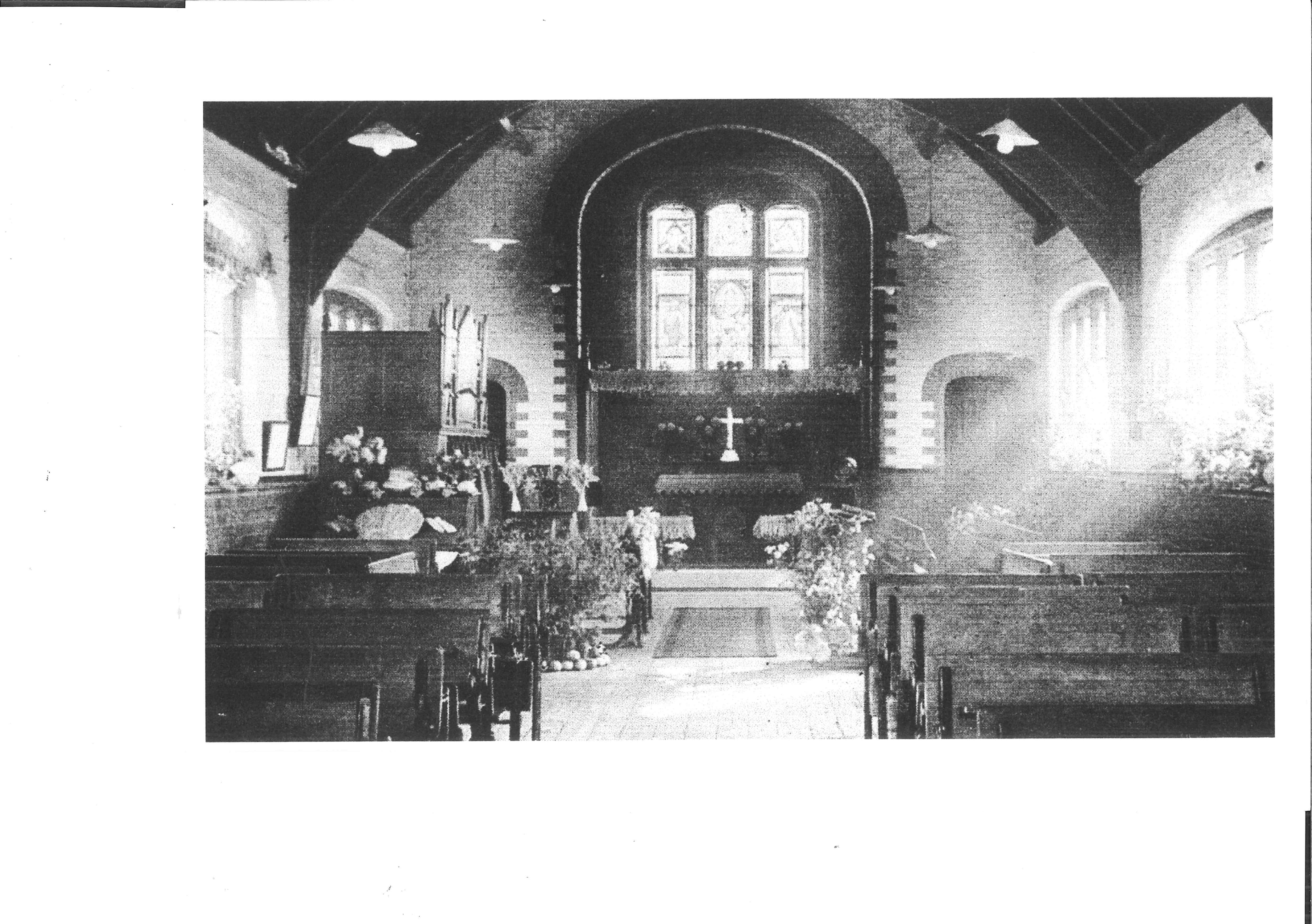
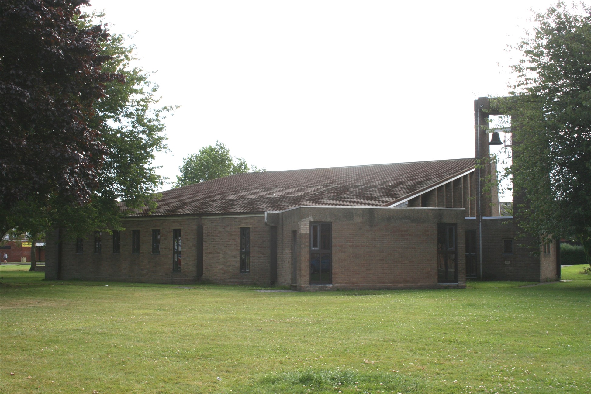
Eventually on 7 May, 1970 The Church of the Ascension, Woolston was consecrated by the Bishop of Liverpool.
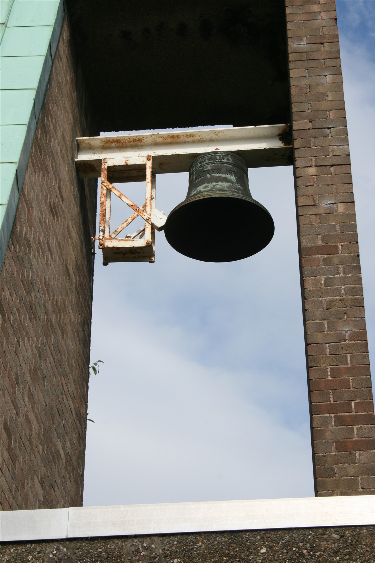
The bell is called Arthur and is said to have come from St Paul’s in Southport
When delivered whoever was in charge said they wanted the bell putting inside the church overnight in-case it was stolen. There were 6 other bells on the wagon being delivered they were left outside their church overnight and were stolen.
When a new church is built something from an old church is added to the new one.
Walk approx 193 metres / 0.12 miles in the direction of the Rope and Anchor until you are nearly at Berkshire Drive.
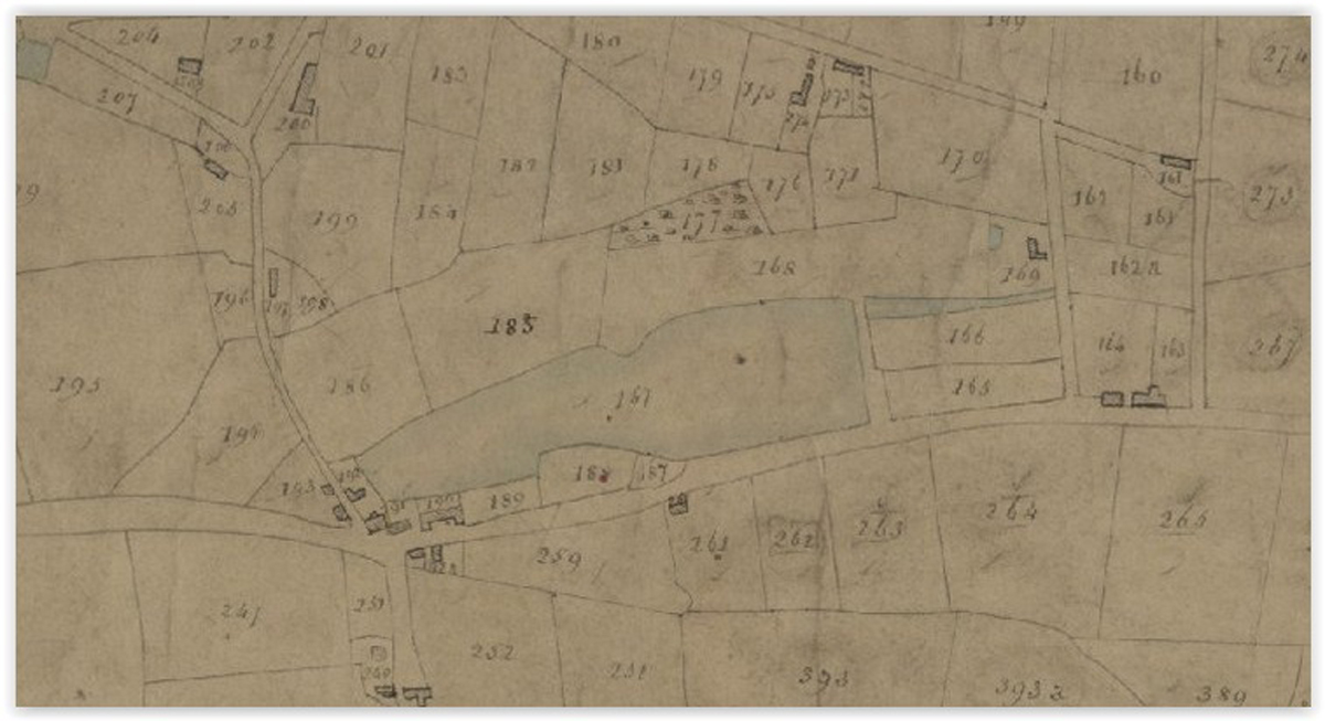
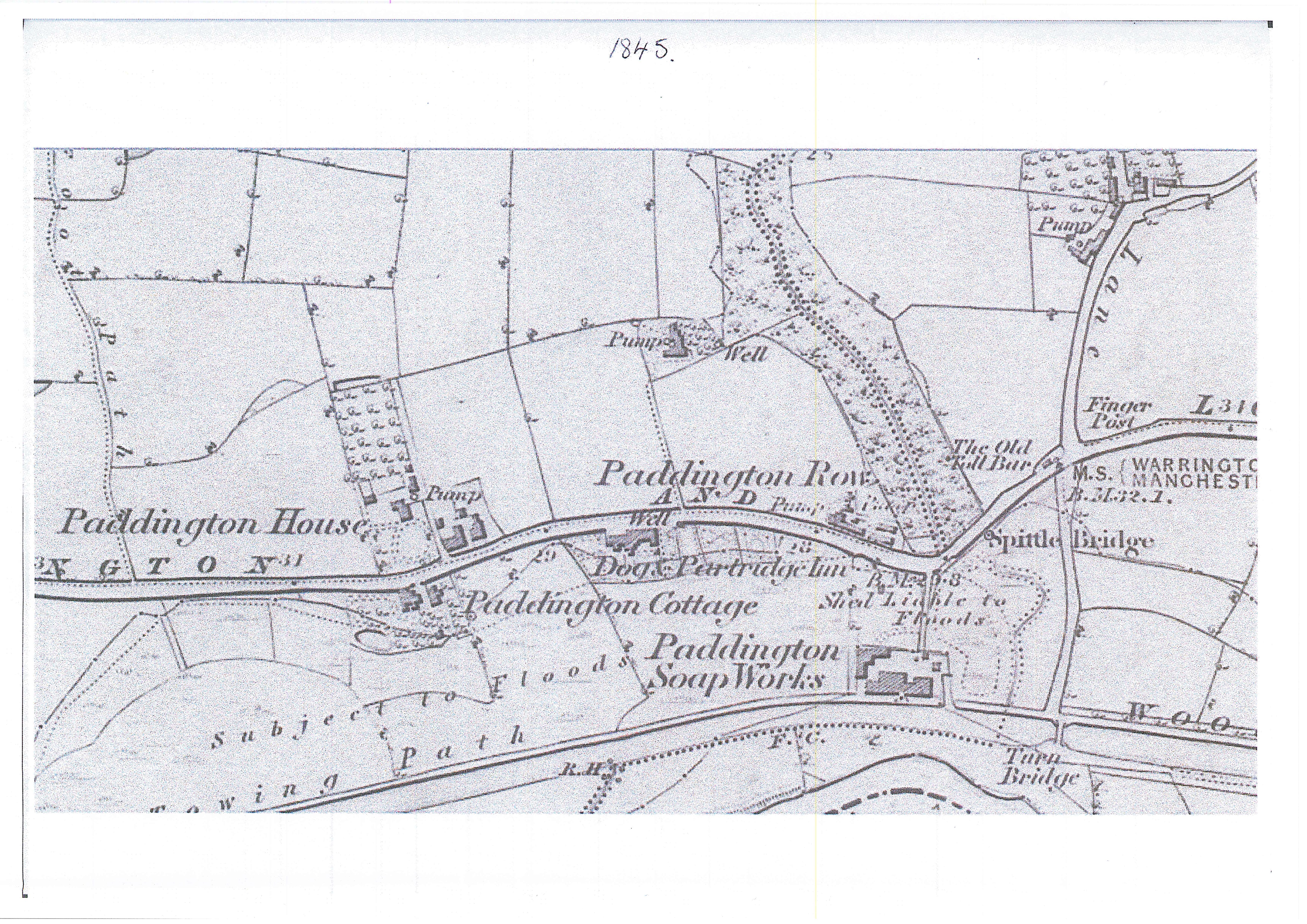
Woolston Tithe Map 1836 – 1851
The mill pond stretched from Dam Lane to Gig Lane. It started behind the old Rope and Anchor and went northwards up to where the house at 16 Dam Lane is now. This fed the mill at the bottom of Mill Lane (opposite the Rope and Anchor)
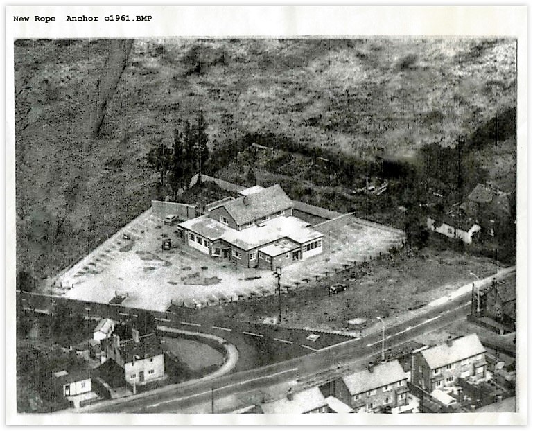
Walk approx 144 metres / 0.09 miles until you reach the Rope and Anchor.
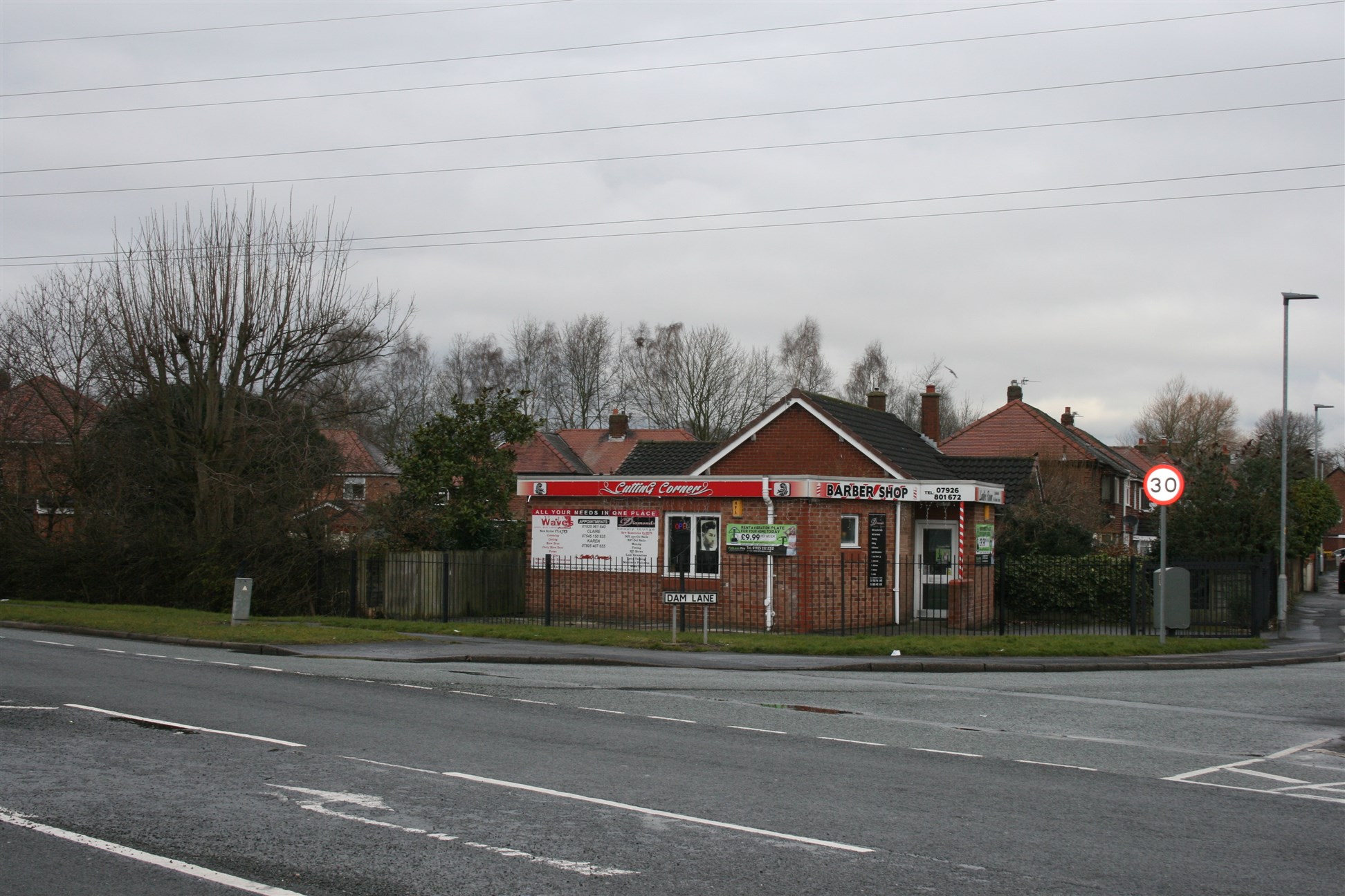
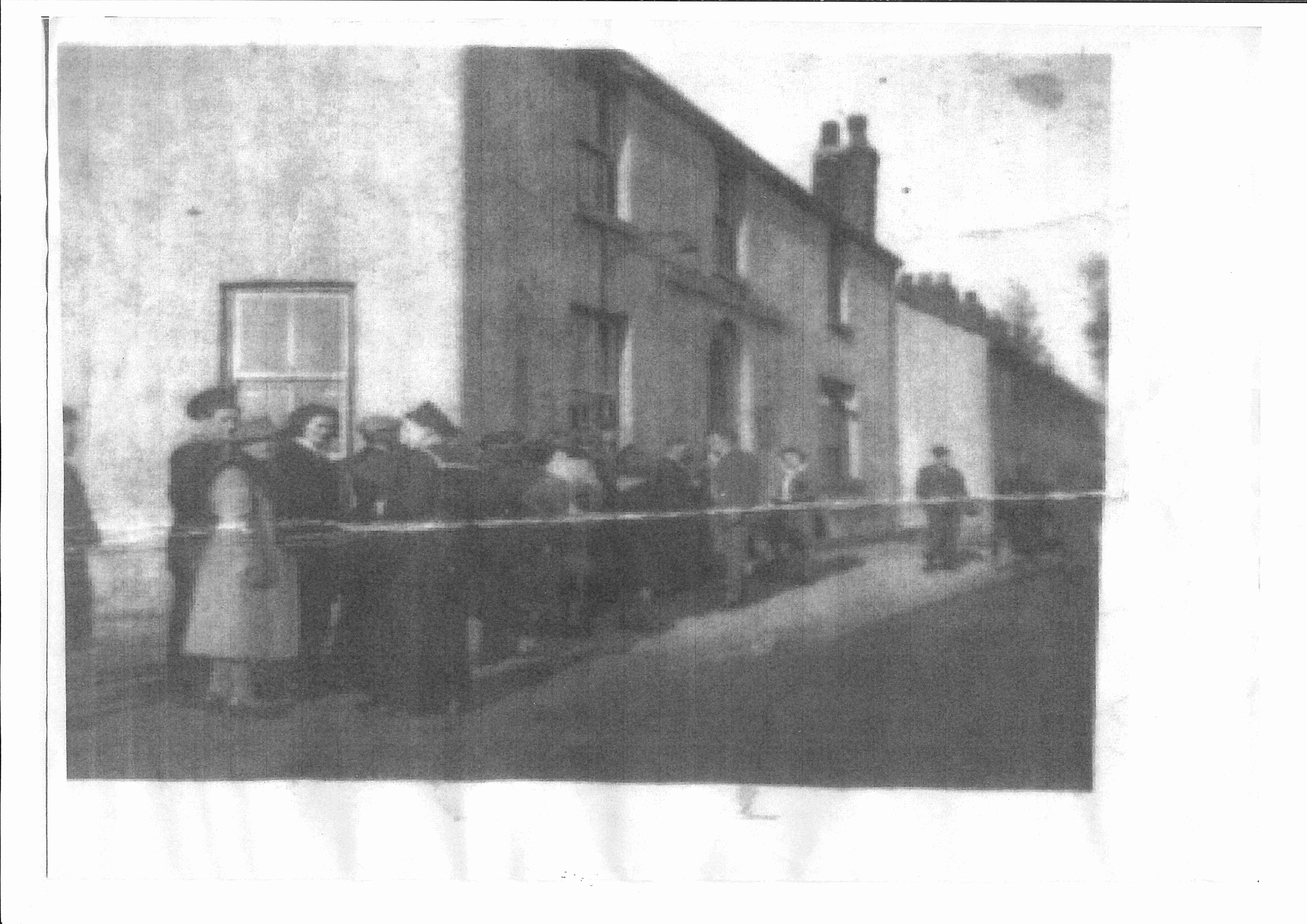
Annie Mellor married Arthur Littlewood in 1944 she was always known as Nancy her shop was on the corner of Dam Lane where the barbers is now.
When Mike Kenwright was a boy he remembered on the western side of Dam Lane were a pair of cottages, an old lady lived in the one nearest to Dam Lane and for a penny a day people could leave a push bike in the shed and then use the bus for the remainder of the journey to Warrington.
On the side of the next-door cottage were Nancy lived there was a wooden “lean to” which was used by Nancy as a grocer’s shop. When the old lady died Nancy and her husband knocked the two into one but it wasn’t long before the council did a compulsory purchase to widen the road, so they built the bungalow on the left of Dam Lane.
Looking at the last photo on the bottom left you can see Nancy’s house and shop. To the left of Nancy’s cottage was a small wood and asbestos building used as a surgery by Doctor Quinta. A new doctor’s surgery was built on the corner, this is now the barbers.
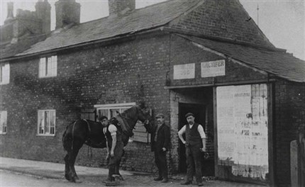
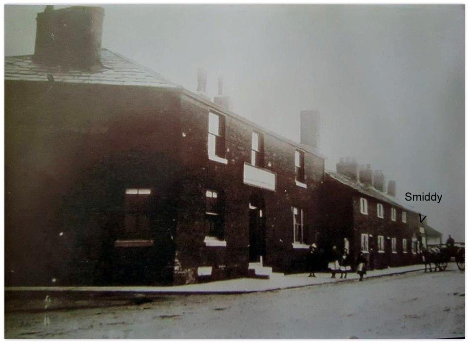
The Smithy on Manchester Road was at the other end of the row to the Rope and Anchor.
The second picture shows the Rope and Anchor then the cottages and then the Smiddy which appears to have living accommodation. No’s 192 & 194 on the 1939 register are the first two cottages, we assume that the Smiddy was No 196. No’s 200 & 202 were a pair of large, good quality red brick houses named Cheshire View.
Between Cheshire View and the Smiddy was a wooden bungalow set back a little and was end on to the road, this must have been No 198.
Mike Kenwright never saw the Smiddy in use and doesn’t know when it closed.
The Hynes family lived in the cottage until demolition, their daughter married a man from Gig Lane and they made their home in Woolston.
1901 census blacksmith
James Daintith age 50, Elizabeth Daintith age 51, Annie Daintith age 27, Joseph Daintith age 25, Alice Daintith age 24, James Daintith age 20, Sarah Daintith age 19, Herbert Daintith age 17,, Harry Daintith age 15, Elsie Daintith age 8.
1891 census blacksmith
James Daintith age 40, Elizabeth Daintith age 41, Annie Daintith age 17, Joseph Daintith age 15, Alice Daintith age 13, Mary Daintith age 12, James Daintith age 10, Sarah Daintith age 9, Herbert Daintith age 7,, Harry Daintith age 5.
1881 census blacksmith
James Daintith age 30, Elizabeth Daintith age 31, Mary Daintith age 9, Annie Daintith age 7, Joseph Daintith age 5, Alice Daintith age 3, Mary Daintith age 2, James Daintith age 7 mths.
1871 census
1861 census blacksmith
John Daintith age 38, Sarah Daintith age 40, James Daintith age 10, William Daintith age 3.
1851 census
John Daintith age 28, Sarah Daintith age 31, James Daintith age 4 months.
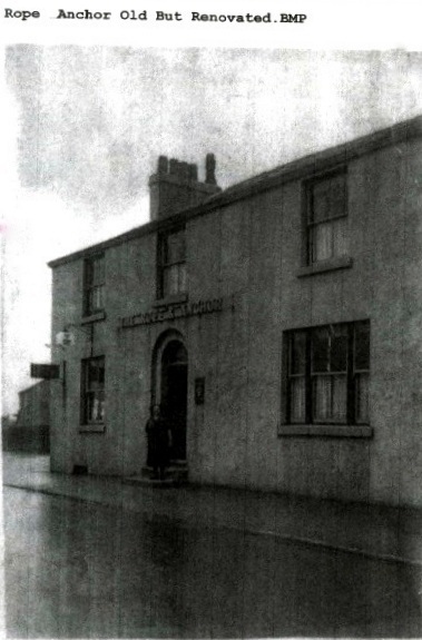
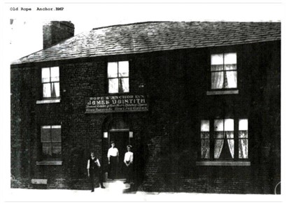
Manchester Road publican James Daintith on the photo.
The old pub was built right on the corner of Manchester Road and Dam Lane, it obscured the road ahead when approaching the junction, resulting in a number of traffic accidents. The new pub was built behind the old building which was only demolished when the new building was completed.
There were two cottages on Manchester Road on the East side of the old pub together with a smithy.
Opposite the pub, at the top of and East of Mill Lane were 3 or 4 cottages, probably situated on the now wider A57 carriageway.
In 1869 (Woolston Hall Estate mentions Rope and Anchor” Inn in the village of Woolston
From 1841-1861 William Turner was publican, 1871-1911 the Daintith family.
1911 Census Inn Keeper
James Daintith age 60, Elizabeth Daintith age 61, Alice Reeves age 33, James Daintith age 30, Herbert Daintith age 27, Elsie Daintith age 18, Gwendoline Reeves g/d age 1.
1901 Census Inn Keeper
Henry Daintith age 36, Alice Daintith age 37, Ann Daintith age 11.
1891 Census Innkeeper
James Daintith age 67, Alice Daintith age 61, Thomas Daintith age 46, Mary E g/d age 19, Alice g/d age 17.
1881 Census Publican /Wheelwright
James Daintith age 58, Alice Daintith age 55, Henry Daintith age 17.
1871 Census Licenced Victualler and Smith
John Daintith age 50, Sarah Daintith age 51, James Daintith age 20, William Daintith age 13, Henry Daintith age 13.
1861 Census Publican
William Turner age 46, Mary Turner age 34, John Turner age 10, Lucy Turner age 8, Mary Turner age 5, Lizzie Turner age 5 months.
1851 Census Farmer?
William Turner age 36, Mary age 24, John Turner age 2, Hannah Turner age 11 months.
1841 Census Publican
William Turner age 55, Alice Turner age 55, John Turner age 25, Mary Turner age 20, William Turner age 20, Sarah Turner age 15.
When Mike Kenwright was a boy he remembered on the western side of Dam Lane next to the Rope and Anchor there were a pair of cottages, an old lady lived in the one nearest to Dam Lane and for a penny a day people could leave a push bike in the shed and then use the bus for the remainder of the journey to Warrington.
Walk approx 128 metres / 0.08 miles across Manchester Road down Mill Lane.
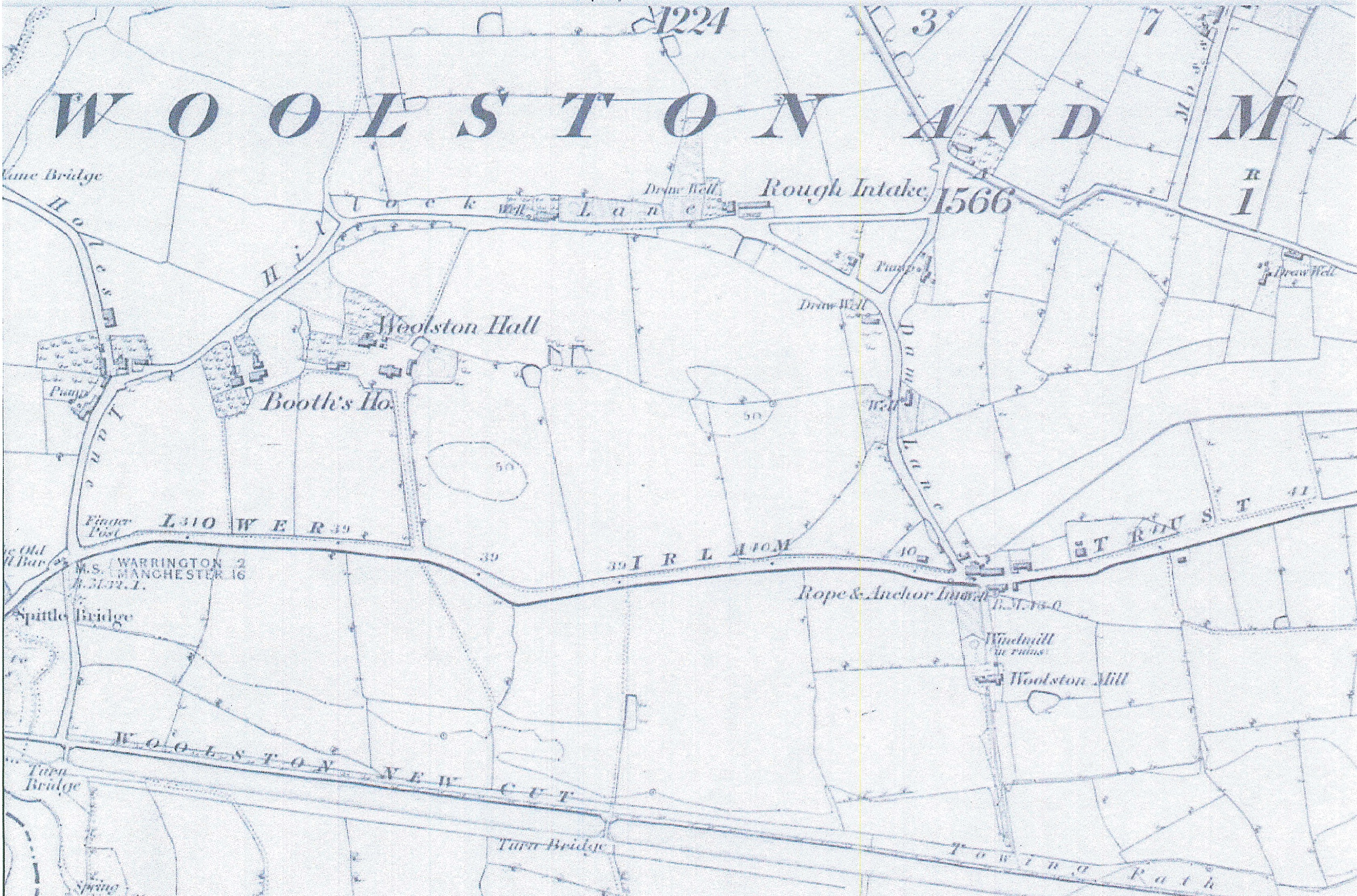
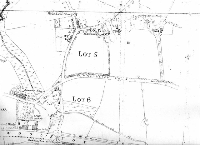
If you look at the map on the right at the bottom you will see it was between the Rope and Anchor and the Corn Mill.
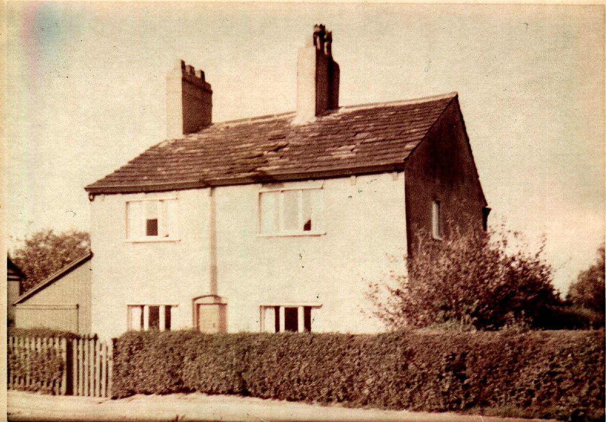
The existing Corn Mill house is still lived in and the water course can still be seen running from Manchester Road to the New Cut Canal.
There have been various mentions of Woolston Corn Mill one was dated 1850.
Two early mentions of the mill at Woolston
“In 1581 Adam Hawarden and Alexander Standish had conveyed the manor and family estates by fine to trustees”.
Found in:
The estate was described as twenty messuages, &c., a water-mill, a dovecote, 2,300 acres of land, meadow and pasture in Woolston, Fearnhead, Bruche, Poulton, Marscroft [Martinscroft], and Halewood.
In 1322 William de Moston gave to Henry del Bruche a plat of waste between the Bruche and Poulton, lying between Le Dedemounes slak and the boundary of Poulton; Raines MSS. xxxviii, 407, n. 2. In an earlier deed the mill pool, the causey (i.e. causeway), and the ditches of Robert de Surreys and Richard de Moston are mentioned as the boundaries of this parcel of ground; ibid. 411, n. 2.
1911 census Farmer
Ellen Warburton age 76, Ellen Warburton age 45, James Warburton age 42.
1901 census Market Gardener
William Gatley age 32, Jane Gatley age 28, William Gatley age 6.
1891 census Market Gardener
James Houghton age 74, Sarah Houghton age 67.
1881 census Market Gardener
James Houghton age 63, Sarah Houghton age 60, Ellen Daintith age 28 daughter, William Daintith age 21 Blacksmith, Sarah Daintith age 5, Elizabeth Daintith age 3, William Daintith age 1.
1871 census Agricultural Labourer
James Houghton age 54, Sarah Houghton age 50, Thomas Houghton age 19, Ellen Houghton age 17, James Houghton age 15, Rose Houghton age 10.
1861 census
1851 census Miller
James Clarke age 36, Ellen Clarke age 39, John Clarke age 20, Peter Clarke age 18, Aaron Clarke age 13, Elizabeth Clarke age 10.
1841 census Miller
Matthew Bolton age 40, Sarah Bolton age 38, Thomas Bolton age 15, John Bolton age 12, Matthew Bolton age 10, Sarah Bolton age 9, Elizabeth Bolton age 2, Anne Bolton age 2 months.
Walk approx 675metres / 0.42 miles down the path at the side of the mill, carry on straight until you get to the New Cut Canal, then turn right and carry on until you get to Bridge Lane with C21 complex on your left.
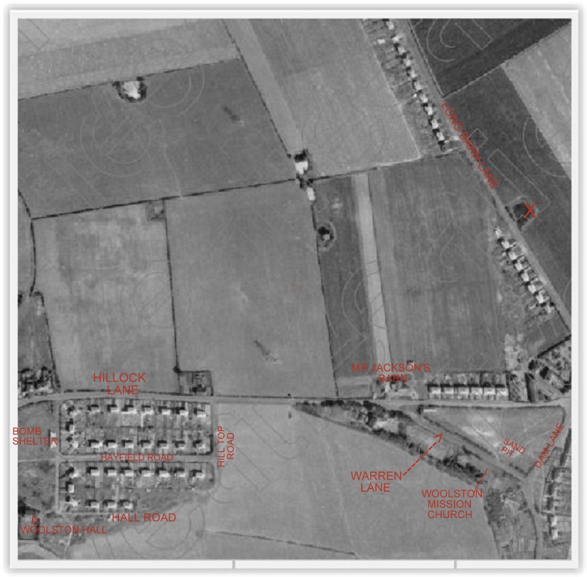
You will see an old photo of Cappers and in the middle of the map where the above were situated.
Coopers Clay Pit
Coopers we believe they originally were working making bricks for the building of the tunnels at Saddleworth. In the 1891 census they were living in a wooden hut. In the 1901 census they had moved and started the Brickworks on the New Cut at Woolston, Cooper’s Pit, clay pit.
Gaskells – Bacon Factory
THE LONDON GAZETTE, 26TH NOVEMBER 1970
NOTICE OF APPLICATION TO VARY A LICENCE TO ABSTRACT WATER Notice is hereby given’ that an application is being made to the Mersey and Weaver River Authority by Gaskell Bros. Ltd., The Bacon Factory, Woolston Warrington, Lancashire, to abstract water from The Old Clay Pit at Woolston. The variation applied for is to abstract from a borehole adjacent to the Old Clay Pit in addition. No increase in authorised abstraction rate is requested. A copy of the application and of any map, plan or other document submitted with it may be inspected free of charge at The Bacon Factory, Woolston, Warrington, at all reasonable hours during the period1 beginning on 1st December 1970 and ending on 1st January 1971.
Cappers
William Henry Capper started business as a pipework fabricator in 1934, in small premises at Woolston, near Warrington, Cheshire. Formed in 1937, it was one of the founding members of the Capper Neill Group.
Now much enlarged, deals predominantly with oil, gas, chemical, petrochemical, and power generation industries with a range of quality shop fabricated equipment.
Walk approx 305 metres / 0.19 miles and look to your left to see Grey Mist. Carry on approx 289 metres / 0.18 miles to Woolston tip.
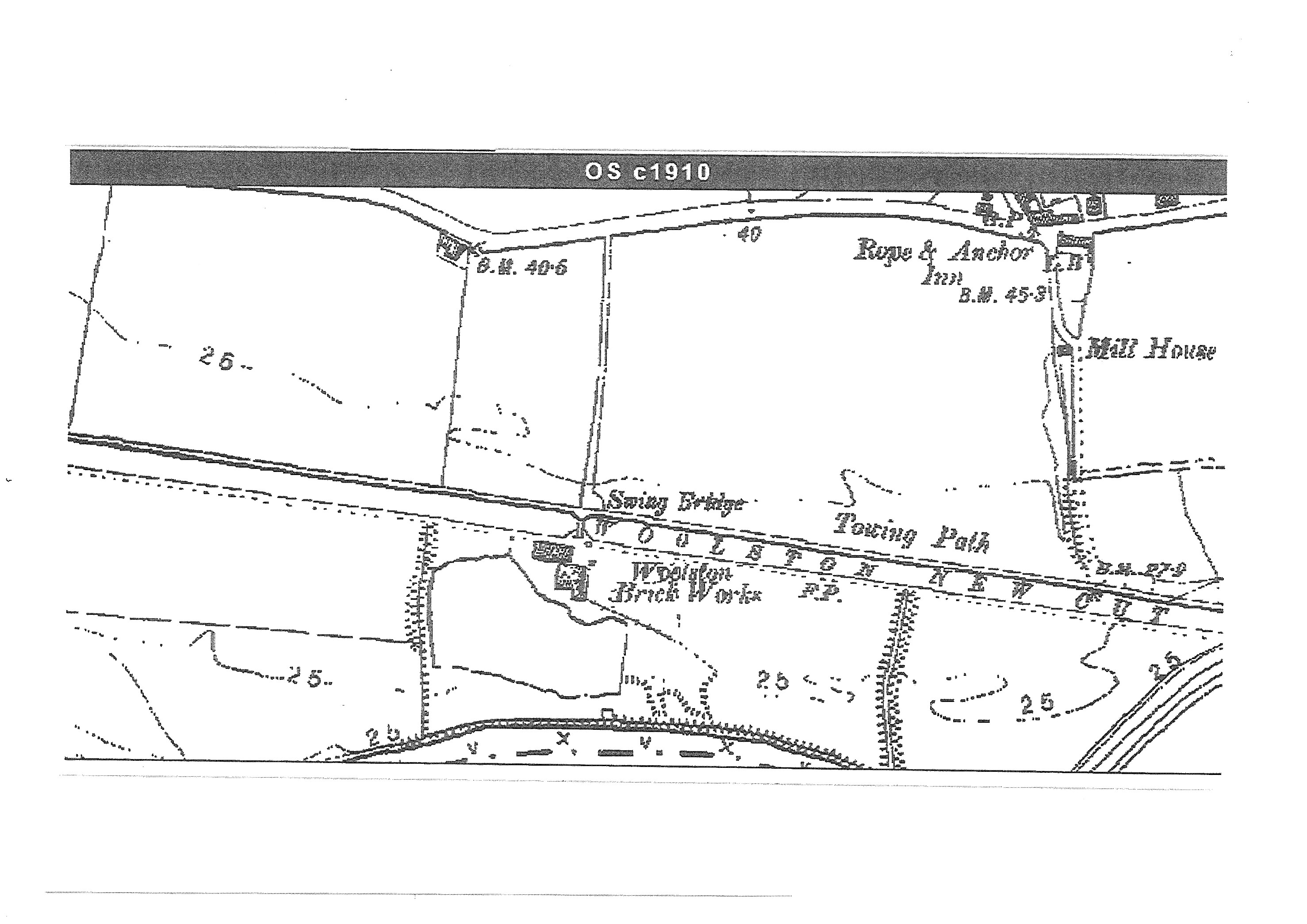
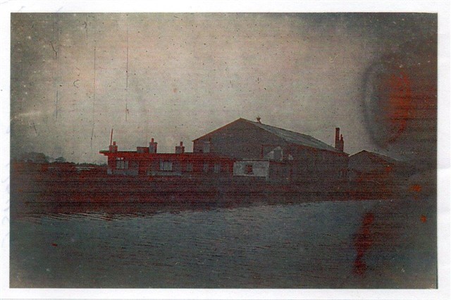
In the bottom right-hand corner of the photo is Gorton’s Brick Works. We aren’t sure if it was still in production when the picture was taken.
Grey Mist Mere is the direct result of clay extraction for the works, the clay was mixed with slag from the metal industries around Warrington to produce what we believe was a first class brick.
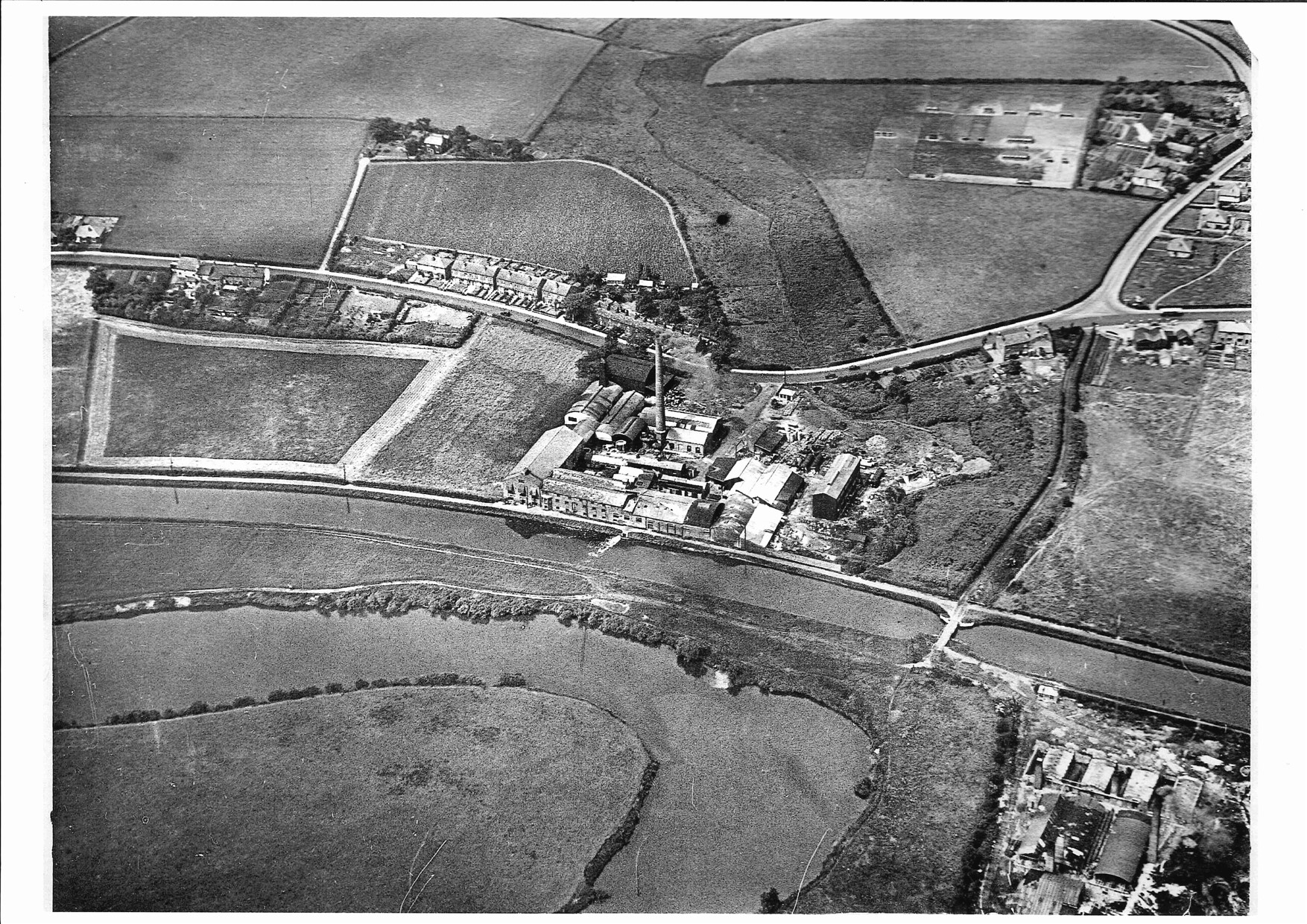
Photo taken c1930 Gortons, Old Dog and Partridge and Paddington Chemical Works
The boiler crossing Soapery Row Bridge, 1930-1940. The boiler could have been for use in the brickworks. If you look carefully at the area just in front of the traction engine wheels you will see the wooden arm which was used as a lever to open and close the bridge.
Walk approx 112 metres / 0.07 miles carrying on along the path passing Woolston Park South on your right, just past this is scrub land where Paddington Chemical Works was.
In 1820 Paddington Chemical soap works was erected on part of the old Bruche estate owned by Johnathan Jackson. The name Paddington is thought to have been given the by Robert Halton thought to be part Padgate and part Warrington he became Jackson’s partner in 1821.
Three years later the excise officers recovered £6,340 against the partners for double duty upon soap made in a secret boiling room of which no entry had been made in the excise books. The company became bankrupt.
The Paddington Works later became the site of a glue works and the smell from this works at one time was reported to be even more obnoxious than the original.
When Edward Gorton owned it there was a fire in 1952. They manufactured ‘Aspirin’ but the primary business of Edward Gorton Ltd was glues. In 1964 the Gorton family sold out to John Wallace. It eventually was owned by Prosper de Mulder in 1980.
In 1851 The Chester Chronical announced the Paddington Bone Works were selling boiled bones.
In 1868 The Chemical Manufactories listed Christopher Royston at Paddington Works.
The Post Office Directory of 1876 listed W & C Royston as Soap & Chemical Manufacturers.
Slaters Directory of Cheshire of 1895 listed William Royston & Co, Paddington Works, as soap, glue, size & bone manure manufacturers.
Willow bark contains a chemical active ingredient called salicin, which the body converts into salicylic acid (C7H6O3) – a pain reliever and anti-inflammatory agent that was the precursor to aspirin. In the 1920’s chemist learned how to extract salicylic acid from willow bark to reduce pain and fever.
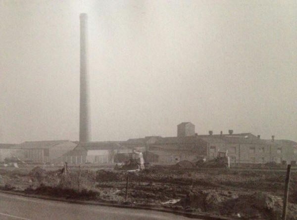
The 180ft Gorton’s chimney was demolished Monday, 6 May 1974.
Walk approx 241 Metres / 0.15 miles back to the start of walk.
We hope you enjoyed the walk and found our heritage interesting.