LEFT CLICK ON MAPS TO ENLARGE
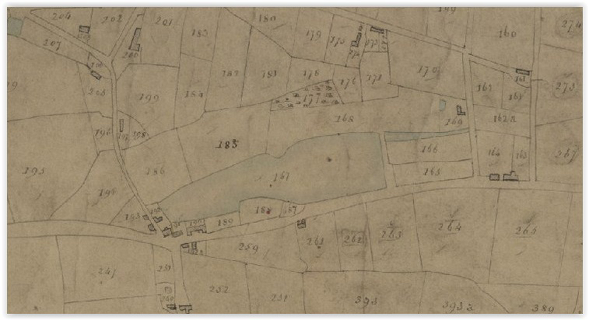
1836 Tithe map showing the Mill Pond,
infront of it the Old Rope and Anchor Inn and Smithy,
down Mill Lane opposite the Mill House.
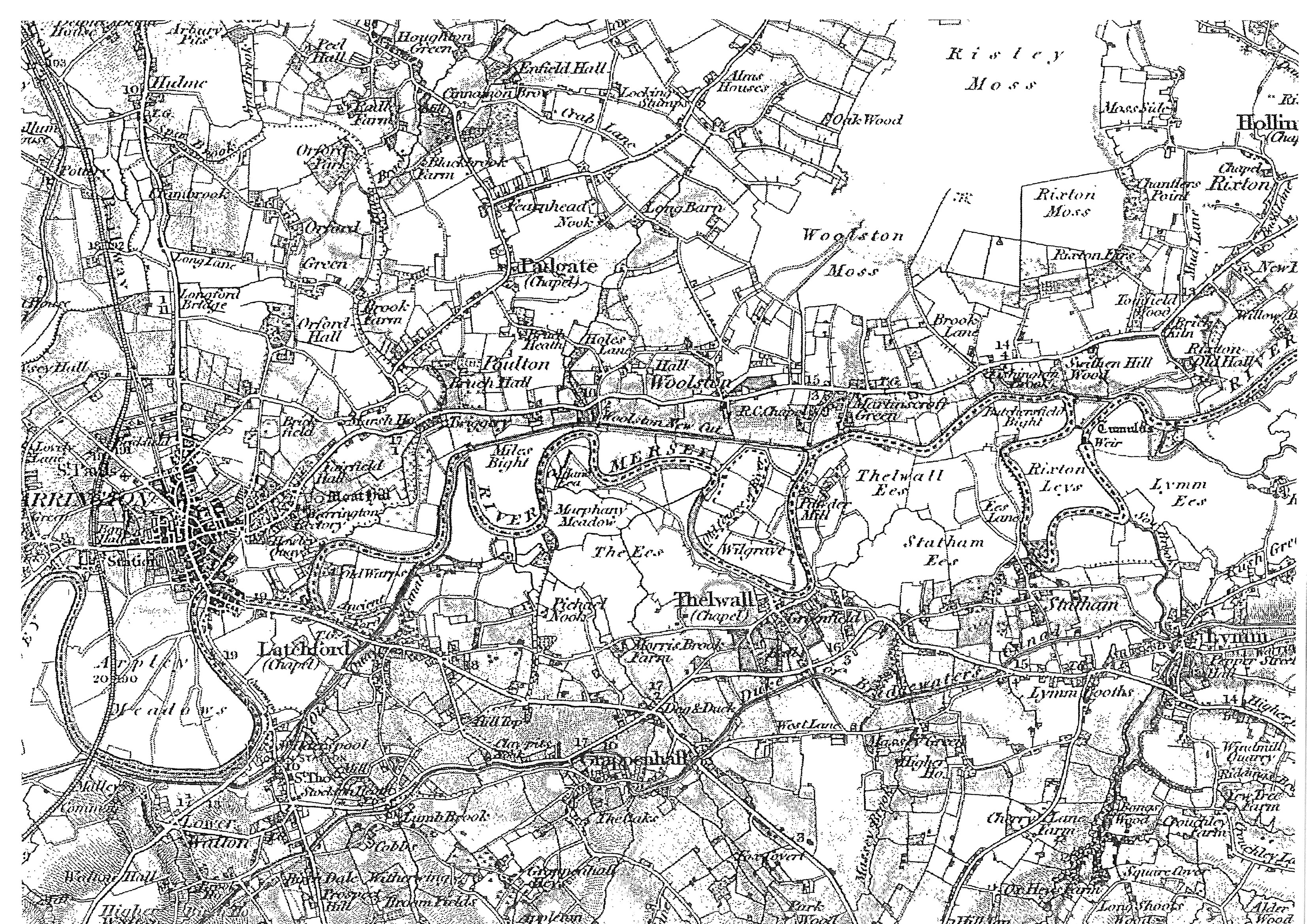
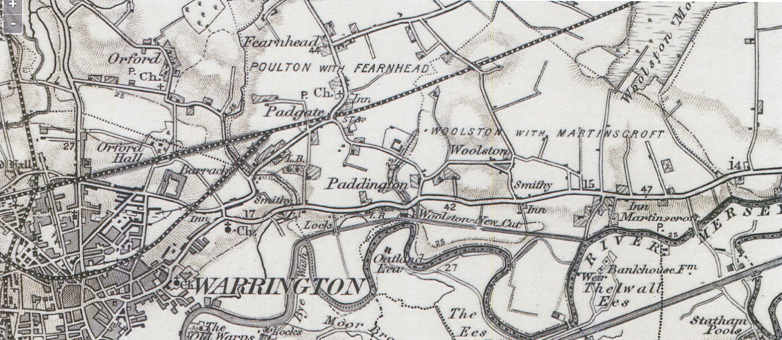
1843 map showing all of Woolston Area
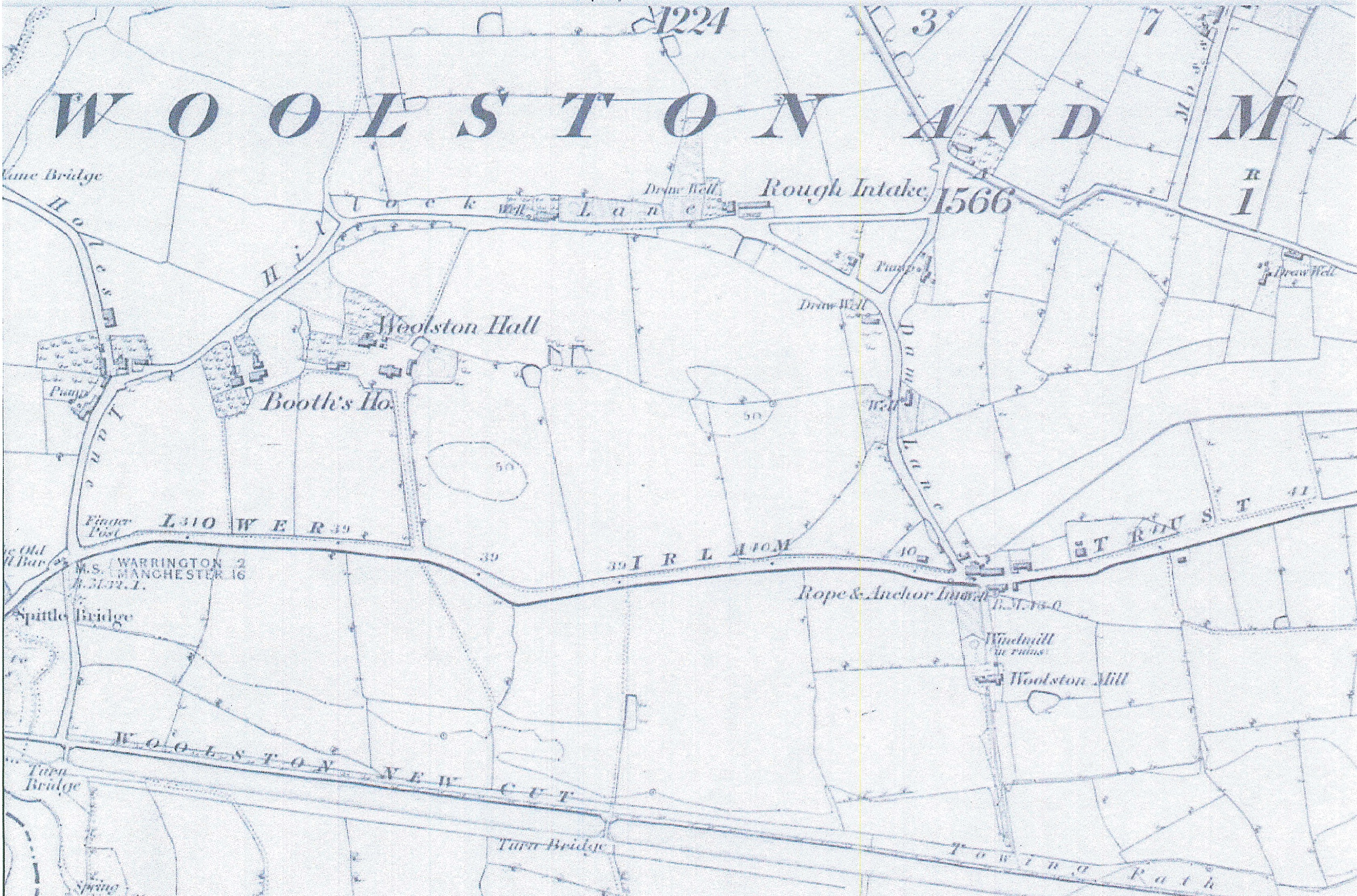
1845 map from the left to right showing
the Old Toll Bar, Finger Post, Spittle Bridge,
2 Turn Bridges along Woolston New Cut,
Woolston Hall, Rope and Anchor Inn,
The Windmill in ruins and Woolston Mill
1845 map from the left to right showing
Paddington House, Paddington Row,
Dog and Partridge Inn and cottages,
Paddington Cottage, Paddington Soap Works,
The Old Toll Bar, Finger Post, Spittle Bridge
and Turn Bridge on the New Cut Canal

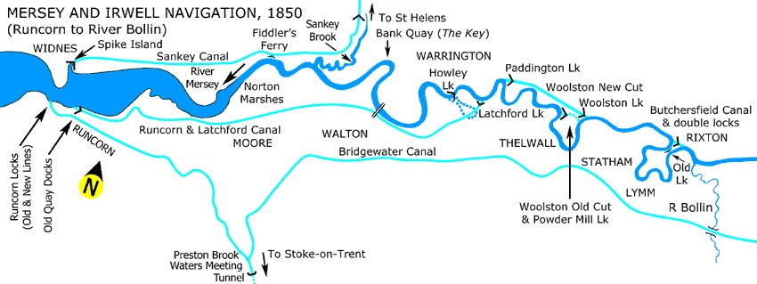
1850 map of the Mersey and Irwell Navigation
from the left showing Howley Lock, Paddington Lock,
Woolston Lock, the Old Cut by Woolston Lock
and Stantons Gunpowder Mill
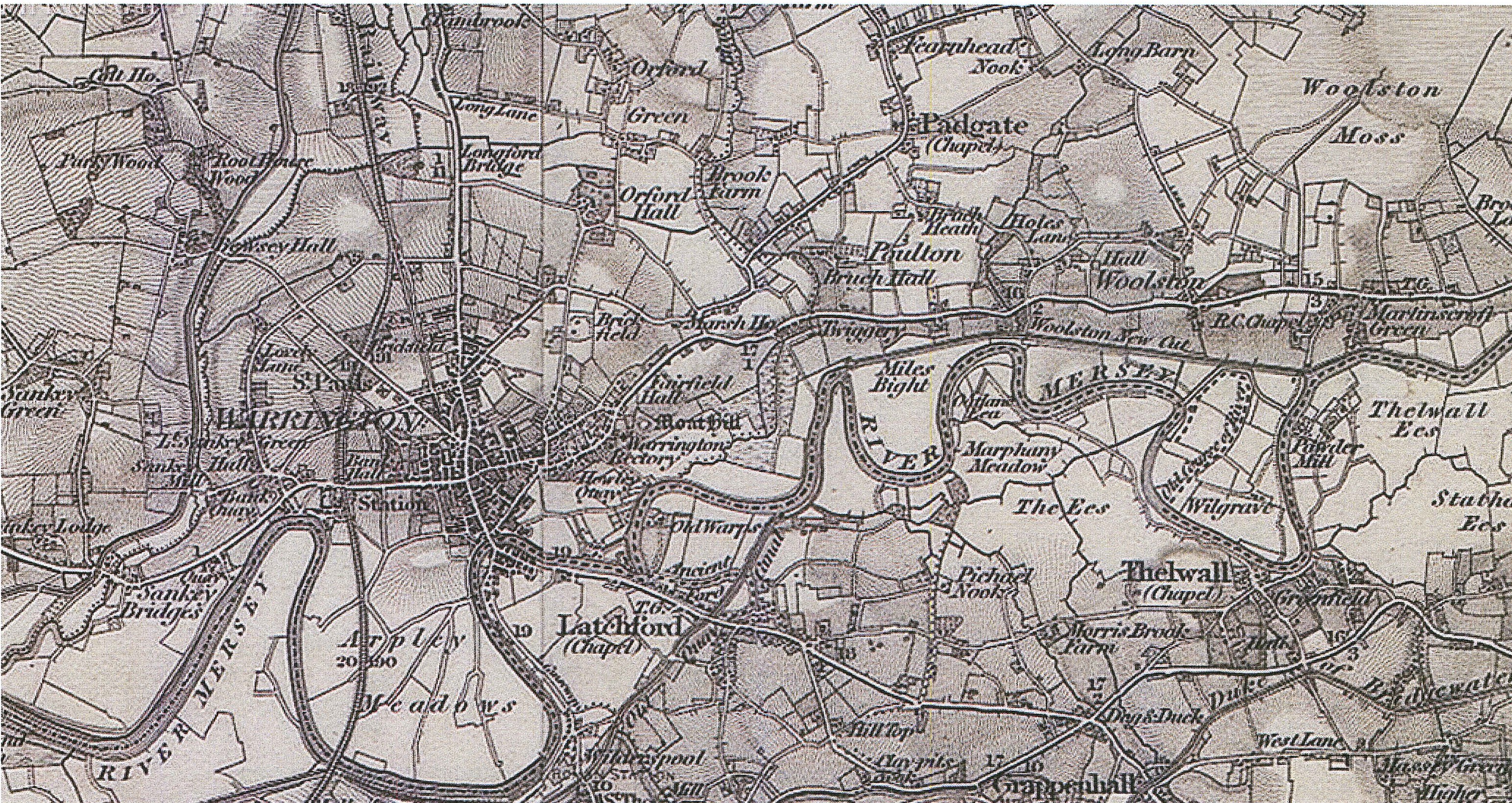
1856 Ordnance Survey map showing from the left
Miles Bight, Woolston New Cut, Woolston Hall,
The Old Cut, Powder Mill and Wilgraves Farm
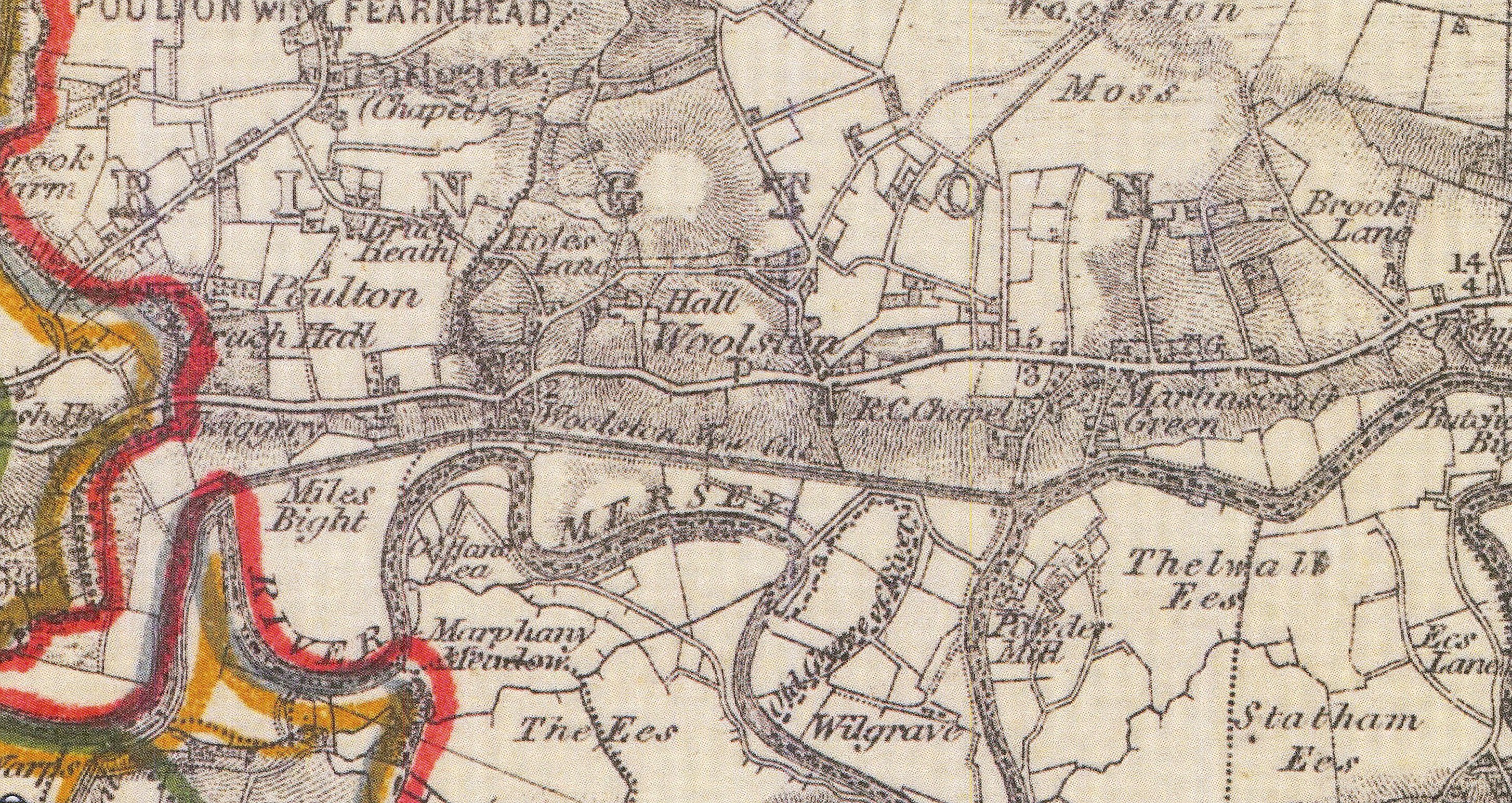
1868 HMSO Boundary map from left to right
showing the Twiggery, Miles Bight,
Woolston New Cut, Woolston Hall, RC Chapel,
Old Cut Canal, Wilgrave Farm and Powder Mill
1895 Runcorn Hills map from left to right showing
Paddington Locks, Woolston New Cut,
Rope and Anchor Inn and Smithy,
Horse and Jockey in at Martinscroft, The Old Cut Canal
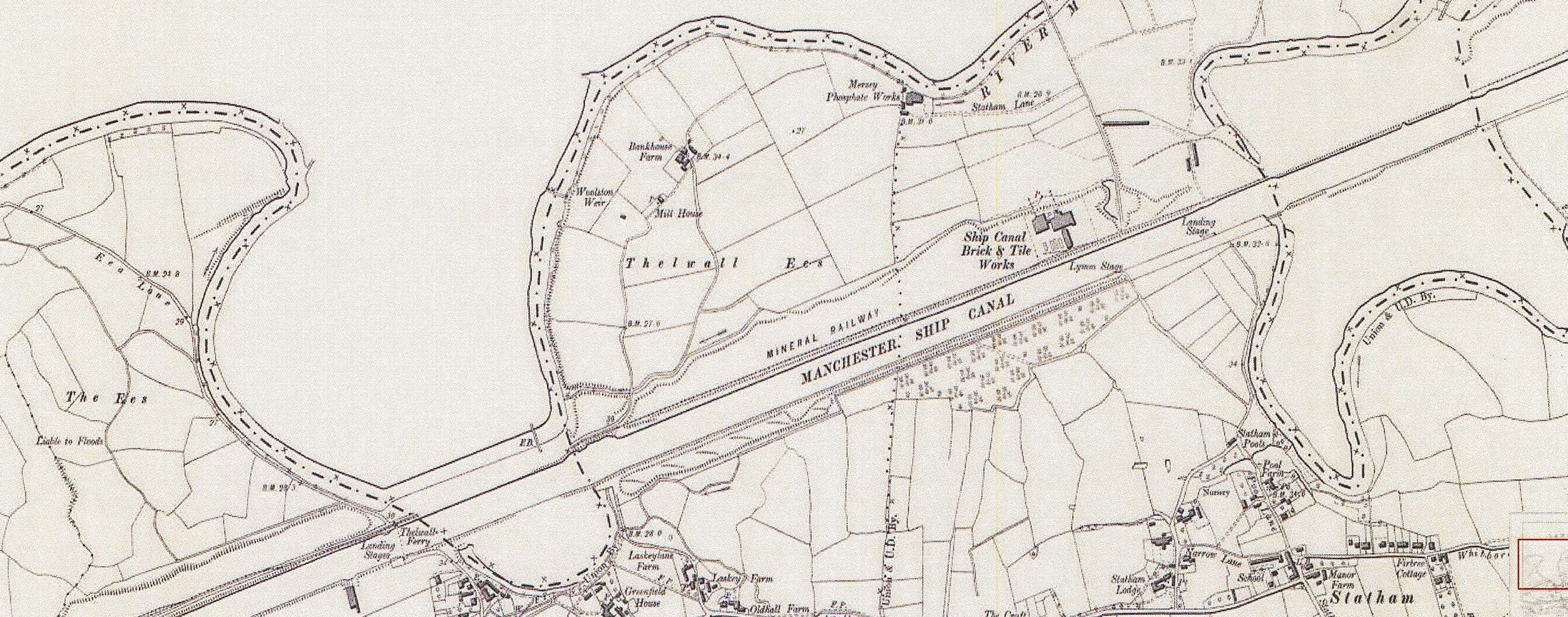
1897 Cheshire-Lancashire from left to right showing
The Ees, a Saxon name and spelling for land near a
looping watercourse, Woolston Weir and Mill House
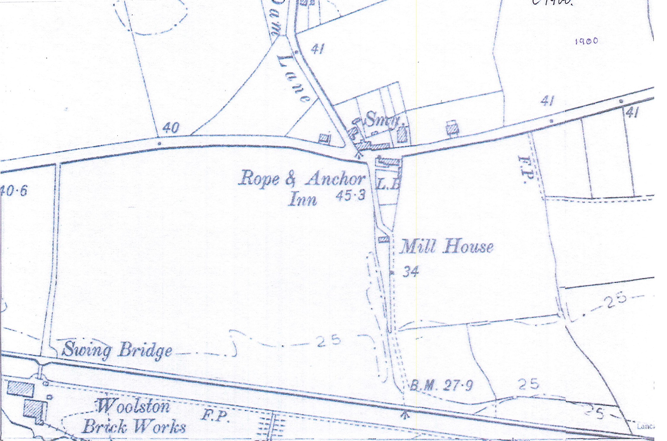
1900 from left to right showing Swing Bridge,
Woolston Brick Works, Rope and Anchor Inn, Smithy
and Mill House
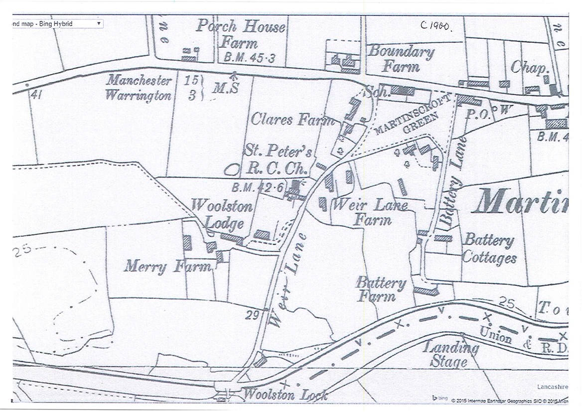
1900 from left to right showing Woolston Lodge,
St Peters, School, Weir Lane, Woolston Lock
Boundary Farm, Post Office and Chapel
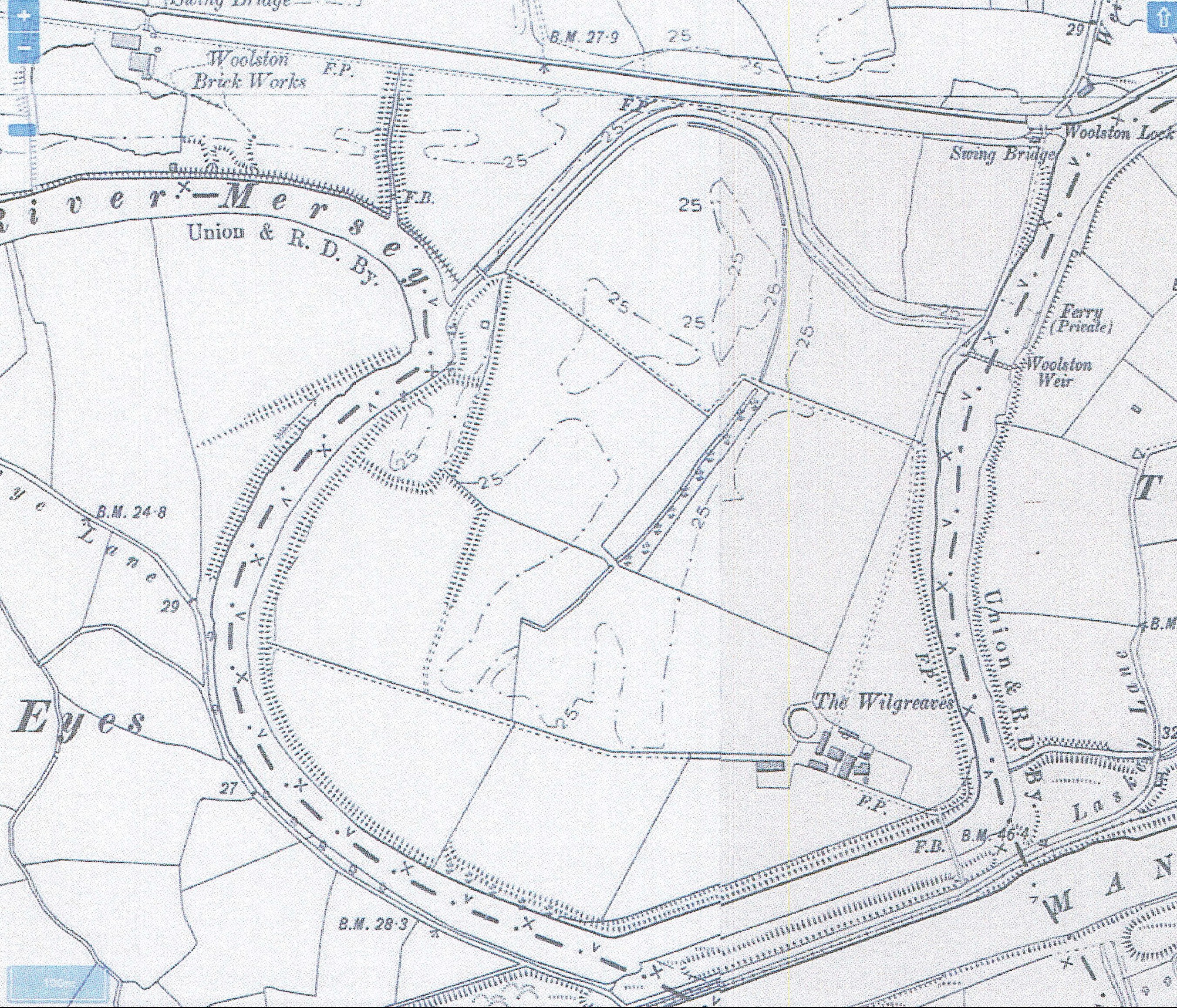
1900 from left to right showing, Swing Bridge,
Woolston Brick Works, Swing Bridge, Woolston Lock,
Ferry (Private), Woolston Weir and Wilgreaves Farm
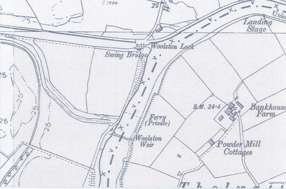
1900 from left to right showing Swing Bridge,
Woolston Lock, Ferry (Private)
Woolston Weir, Landing Stage
and Powder Mill Cottages
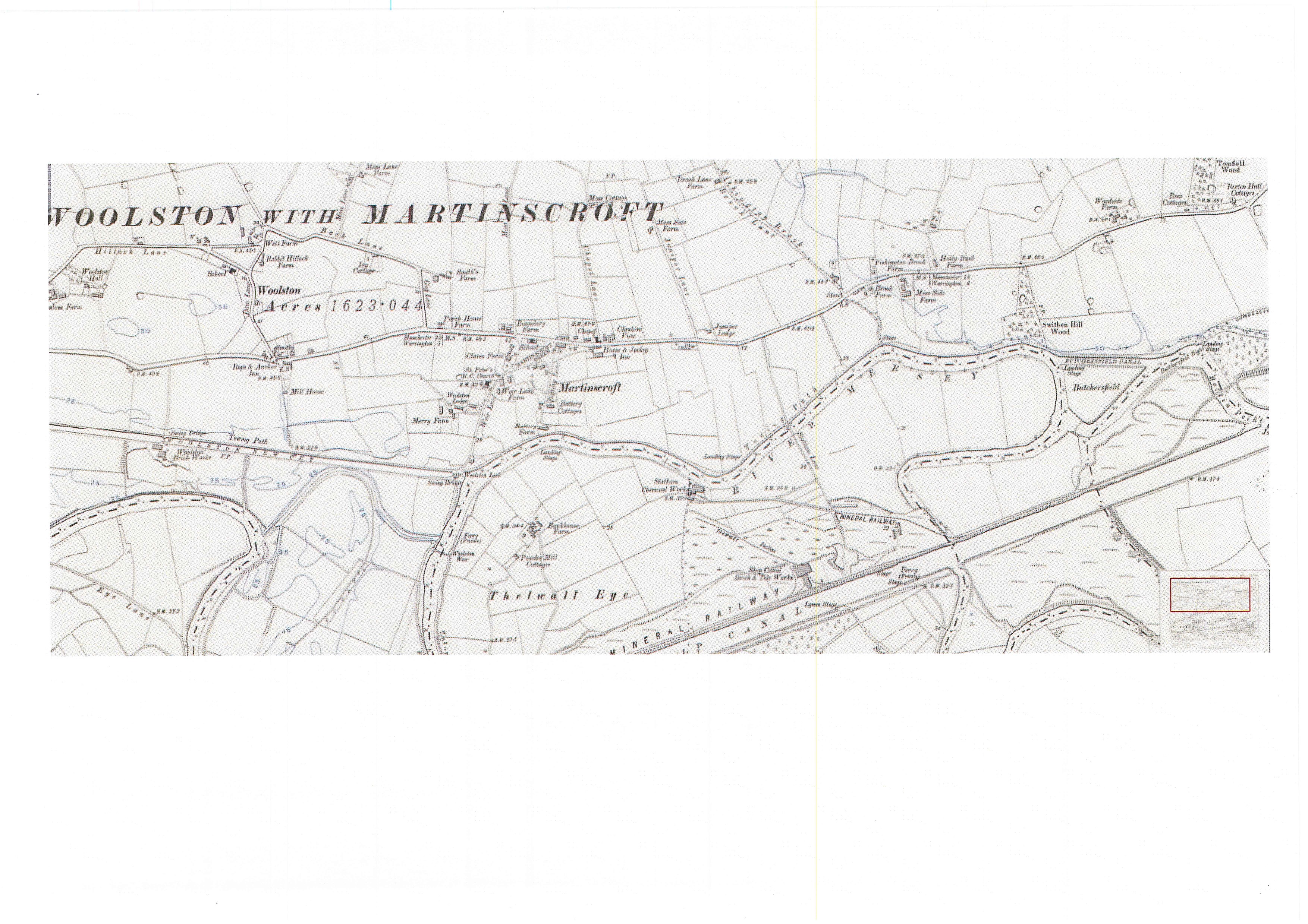
1905, Cheshire, from left to right Woolston Hall,
Swing Bridge, Woolston Brick Works,
Rabbit Hillock Farm, Rope and Anchor, Smithy,
Mill House, St Peters, Woolston Lodge, Swing Bridges,
Woolston Lock, Ferry (Private), Woolston Weir,
Chapel, Horse and Jockey, Powder Mill Cottages
and Statham Chemical Works
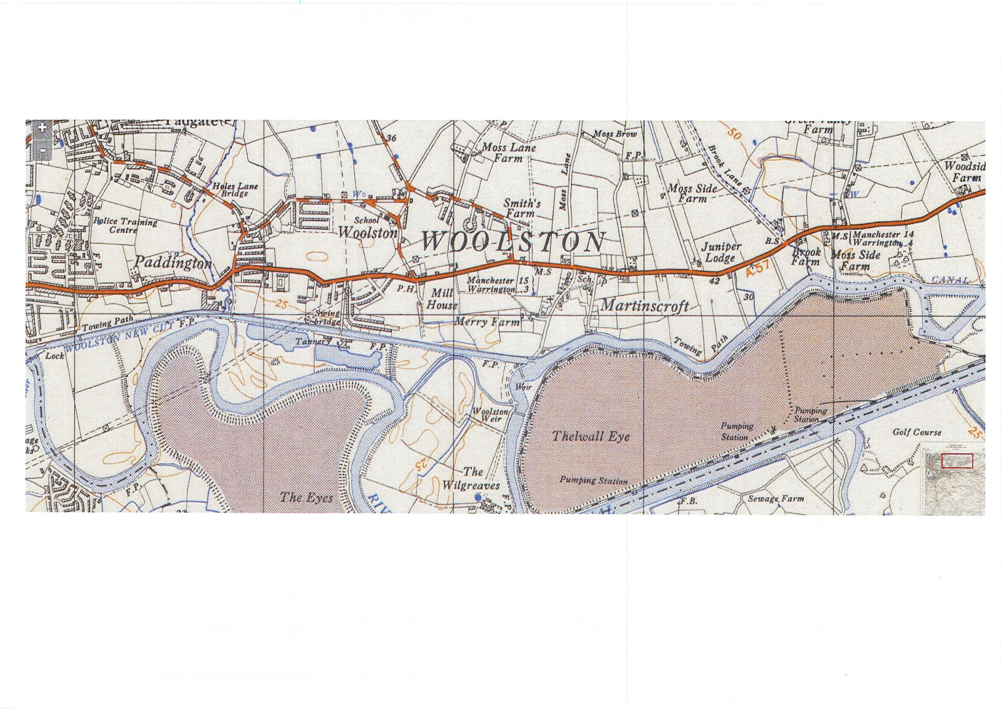
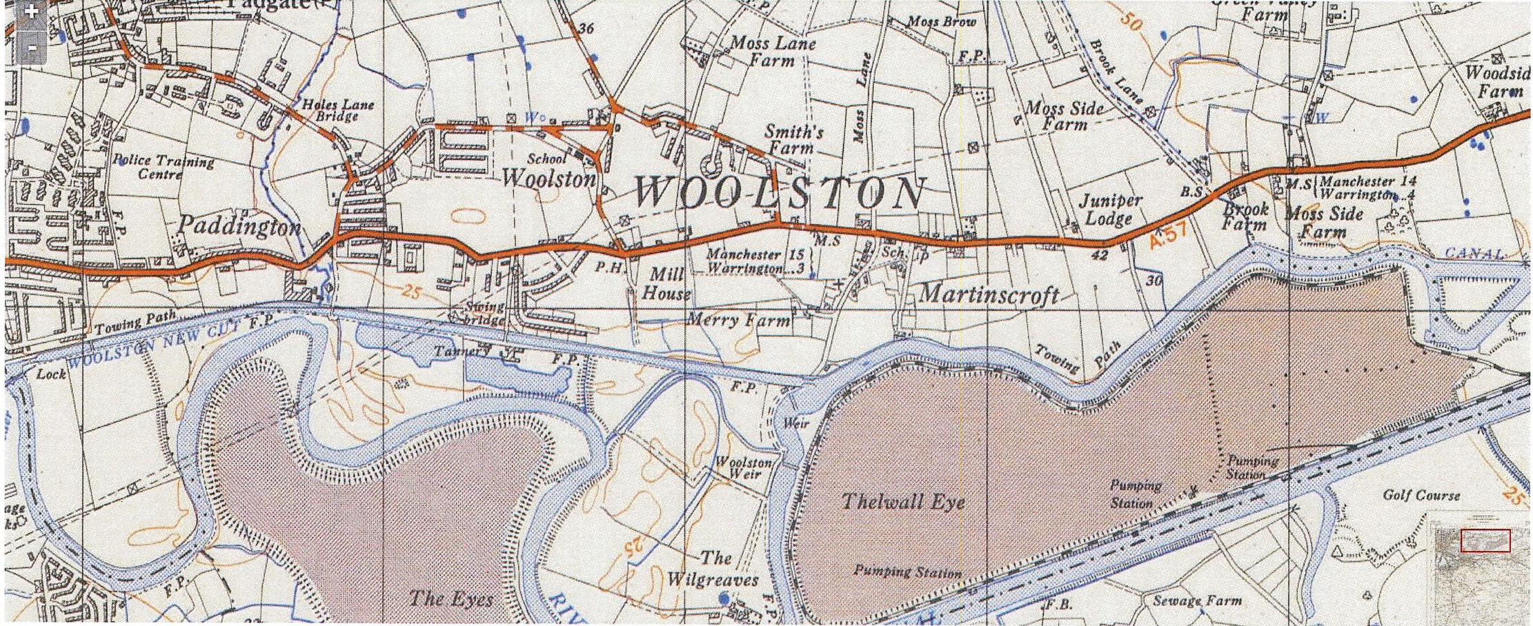
1937 Provisional map, from left to right
Police Training Camp, Paddington Lock,
Swing Bridges, Tannery, Mill House
Woolston Weir, Wilgreaves Farm and School
1938 Cheshire Map from left to right
Greyhound Race Track, Lido,
Swing Bridge, Slaughter House,
Rope and Anchor, Mill House,
St Peters Church, Woolston Lodge,
Woolston Lock, Swing Bridge, Boundary Farm,
Wesleyan Methodist Chapel,
Horse and Jockey Inn and Wilgreaves Farm
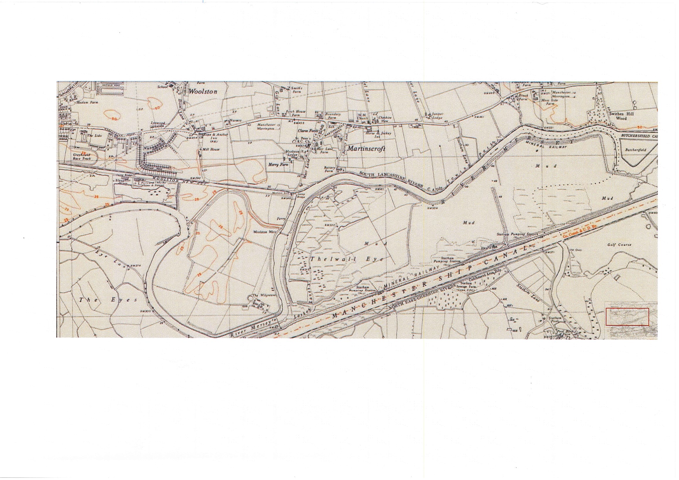
1938 Provisional map from left to right
Police Training Camp, Paddington Lock,
Swing Bridges, Tannery, Woolston Weir
and Wilgreaves Farm
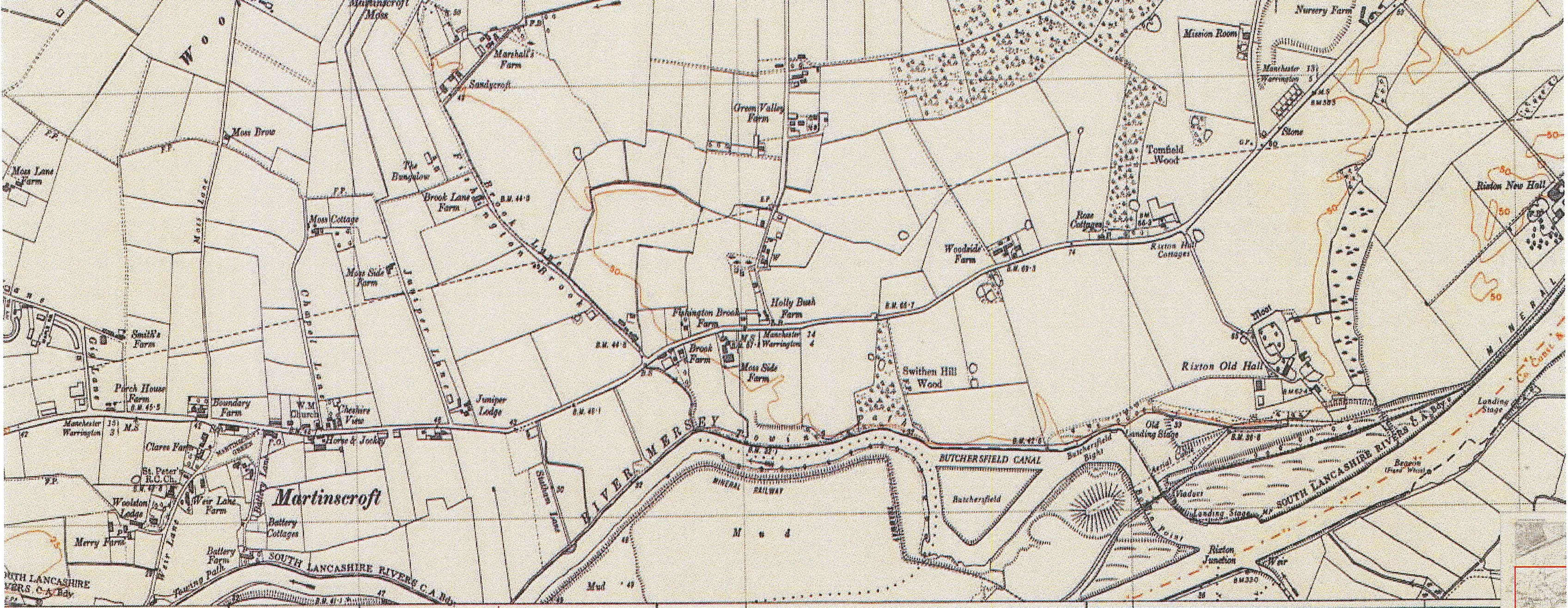
1948 Lancashire map from left to right showing
St Peters Church, Woolston Lodge,
Wesleyan Methodist Church and Horse and Jockey Inn
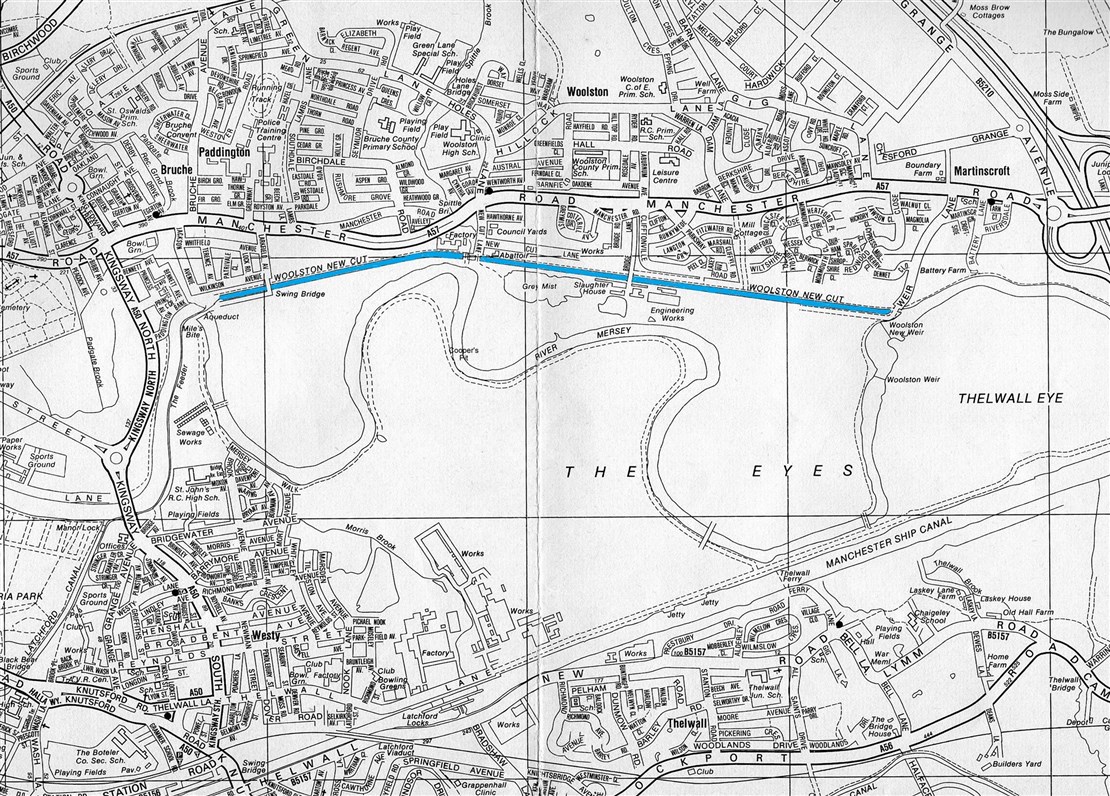
1980 map from left to right Miles Bite, Aquaduct,
Swing Bridge, Factory, Abattoir, Slaughter House,
Engineering Works and Woolston New Weir
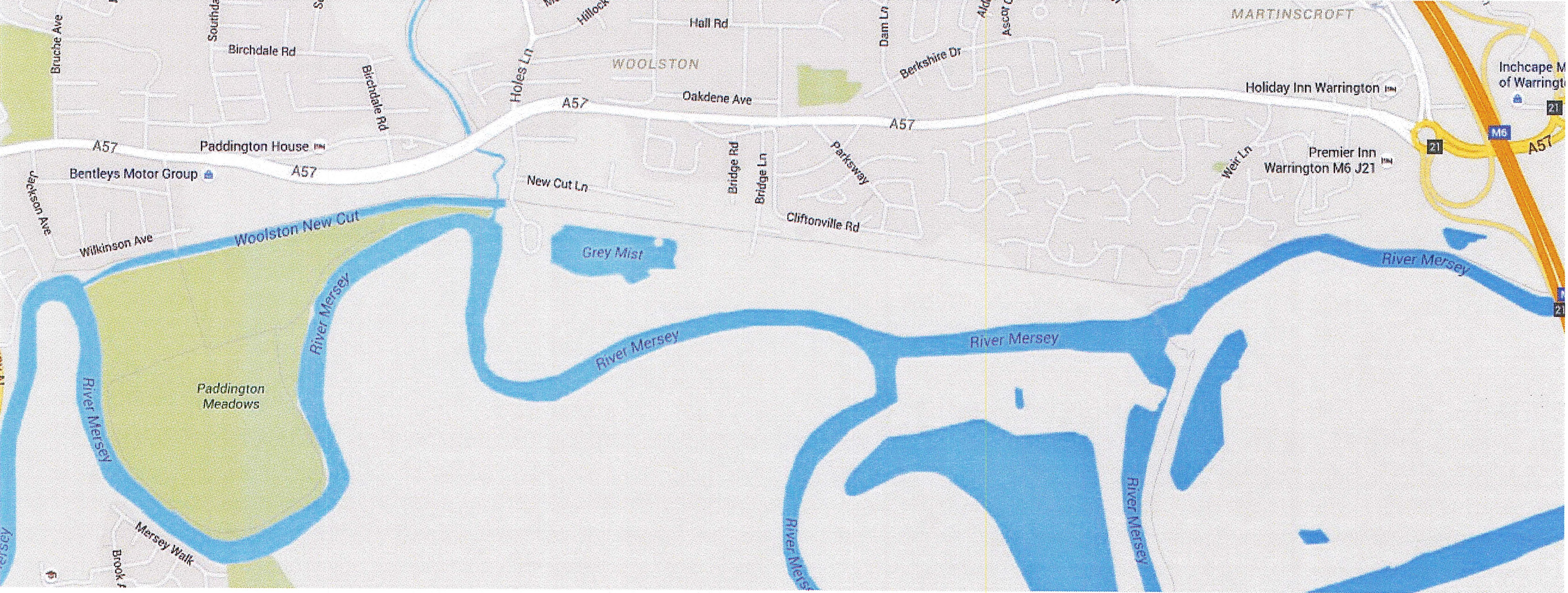
2015 map showing from left to right
Paddington Meadows, Woolston New Cut
and Grey Mist